P07 "Routes of Interaction" - Exploratory trip to Djibouti
In the course of the second funding phase, the interdisciplinary research project continues to aim at investigating intra-African contacts between the northern Horn of Africa, the Middle Nile, the northeast Sudanese Gash Delta and parts of Egypt. The questions anchored in the project about the land of Punt mentioned in Egyptian sources and its possible localisation now led to an expansion of the research area to Djibouti.
The question of the localisation of the land of Punt, the sites where Puntian goods were found and their route to Egypt plays a major role in the “Routes of Interaction” project, especially from the Egyptological perspective. Many researchers equate the Ethiopian-Eritrean highlands and the middle Nile Valley including the Gash Delta, but also regions in Djibouti and Somalia with the land of Punt. While goods from Punt, which maintained trade contacts with Egypt from the middle of the 3rd to the late 2nd mill. BCE, have been evaluated on the basis of written and iconographic sources, primarily from the Egyptian perspective. A systematic study of intra-African trade and exchange of goods from the perspective of the Horn of Africa has been lacking up to now
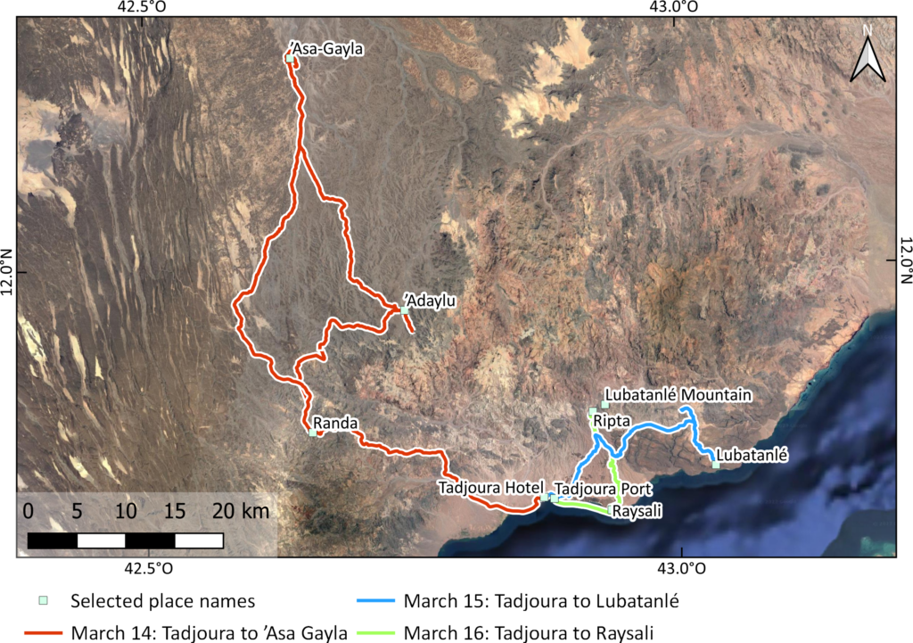
In cooperation with the Research Centre for Ancient South Arabia and North-East Africa at the Friedrich Schiller University Jena (W. Smidt), J. Hardt (Freie Universität Berlin) and K. Pfeiffer (Deutsches Archäologisches Institut) undertook an initial exploratory trip to Djibouti in March 2023. The aims of the trip were to establish contact with the Centre d`Etudes et de Recherche de Djibouti (CERD), to evaluate the geographic-archaeological research potential with regard to ancient route systems, and to conduct initial ethnohistorical research on local traditions concerning the political culture of the Afar. Three scientific excursions and initial surveys (Figure 1) have already yielded important results on the cultural landscape of the region, especially the Sultanate of Tadjoura.
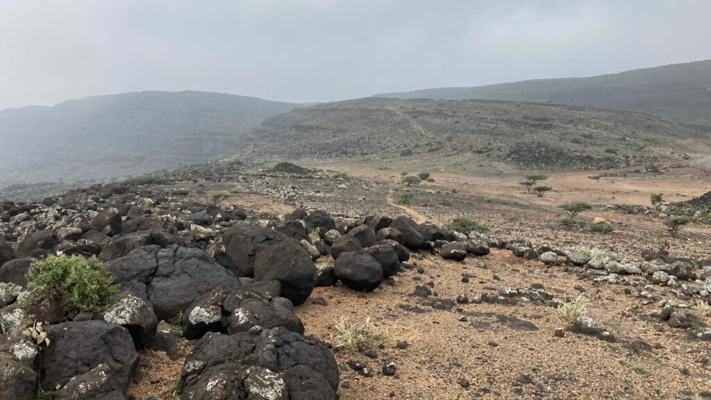
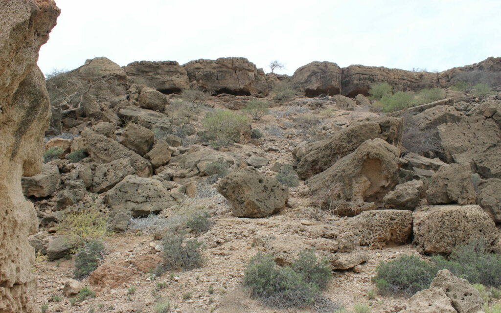
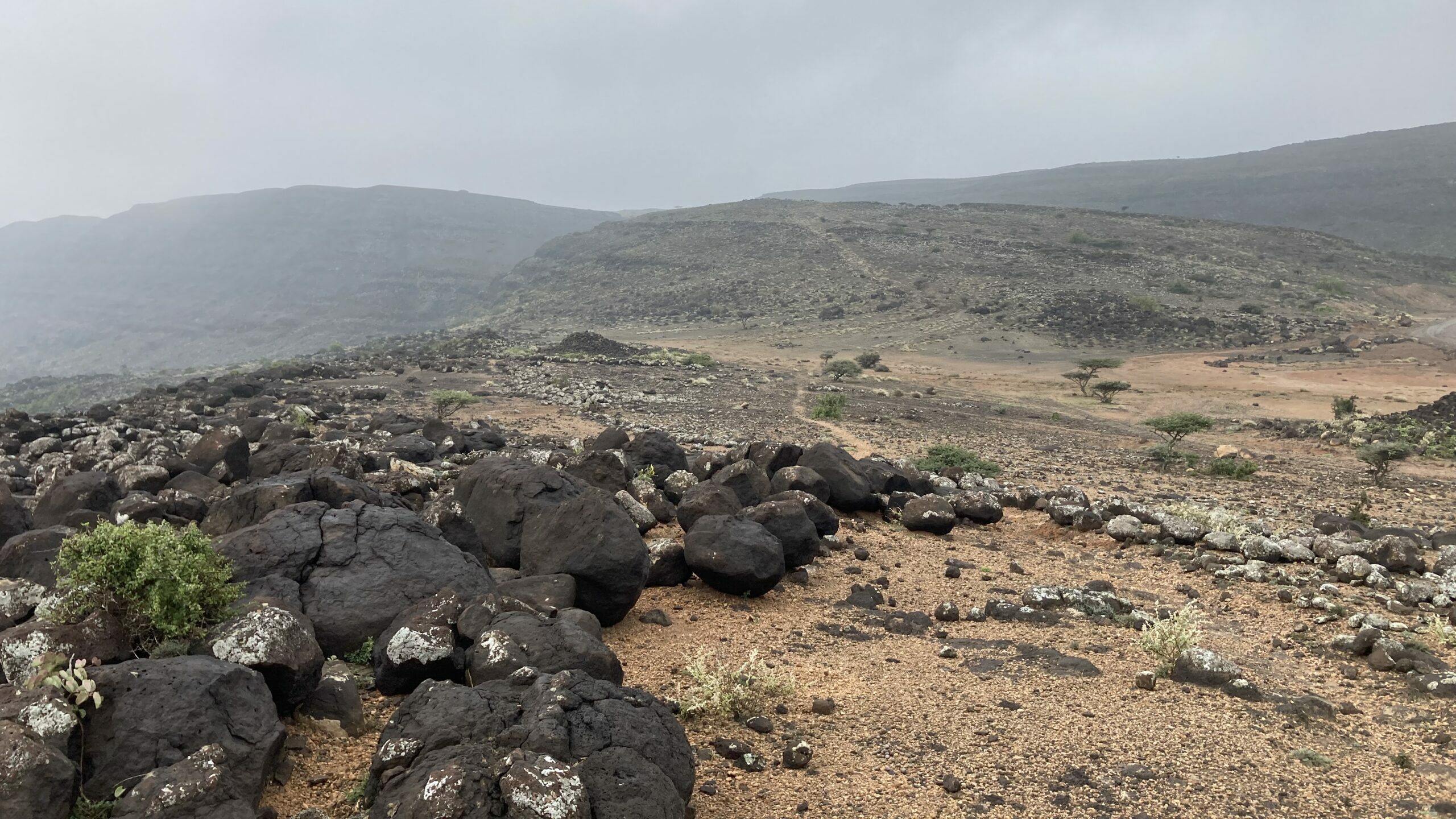
An excursion to the north-east of Tadjoura to the site of ʿAsa-Gayla made it possible to visit previously unexplored tumuli, cemeteries and settlement remains (Figure 2). Of particular interest was also the high diversity of the natural and cultural landscape, the density of contiguous ecozones, and the variety of large geomorphological spaces in the region. On both sides of the site of ʿAsa-Gayla, large groups of tumuli of different sizes and types (Figure 3) extend on higher basalt spurs, as well as isolated stone structures that suggest settlement remains. This area in eastern ʿAsa-Gayla, known by the local population as the Globid Village, is known as a place of special historical and local spiritual significance, which according to ethnohistorical sources can be interpreted as an indicator of a particularly long history of settlement. In addition, an extensive network of paths and trails can be observed connecting this region towards the north. The entire area around ʿAsa-Gayla lies on Holocene fluvial deposits. Drainage pathways from the south, from the stratoid basalt to the west and from the Dalha basalt to the east meet here. Thus, quite good water availability can be assumed in this confluence area.
Figure 2: On the way to ʿAsa Gayla: View along the path that leads up the mountain through the building structures in a southerly direction as a hollowway (Attribution & Copyright: J. Hardt).
Figure 3: One of the numerous tumuli sites of unclear date nearby the village of ʿAsa Gayla (Attribution & Copyright: K. Pfeiffer).
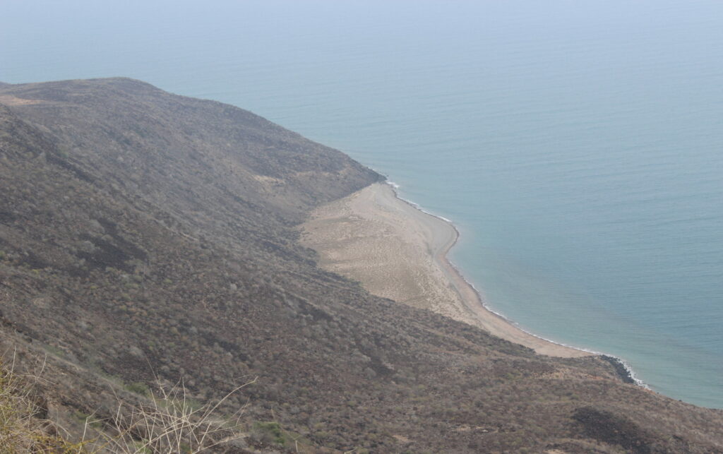
A second excursion led to the site of Lubatanlé on the northern shore of the Gulf of Tadjoura where incense trees grow. A first exploratory survey was carried out with the aim of recording the geographical environment of this raw material as well as possible natural harbours that might be associated with the punt trade. Several very large, contiguous areas with different stone structures were recorded on the cliff and at the site of the frankincense trees, which together form a settlement of considerable size. According to ethnohistorical sources as well as on the basis of the research by the Spanish team, the structures are probably at least medieval and pre-Islamic in date. The structures can be divided into different functional areas: They consist, among other things, of foundation walls for rising buildings, storage installations, stables, cult installations and shepherds’ towers as well as shelters for herd animals, graves. In the area of 1.5 x 2.3 km there are scatters of obsidian flakes, molluscs, and grinding tools, while the number of pottery sherds on the surface is negligible. The settlement remains extend very close to the cliff to the south, which is high above the Gulf at an altitude of about 300 m a.s.l. (Figure 4). Incense trees (Figure 5) (boswellia pap.) grow on the cliffs of the cliff coast and are endemic or were planted there. Even today, the local population is involved in the extraction of incense resin. Along the steep coast there are several smaller bays with sandy beaches, which could be natural harbours for ancient trading ships.
Figure 4: Coastal strip on the Gulf of Tadjoura, view from the incense area Lubatanlé (Attribution & Copyright: K. Pfeiffer).
Figure 5: Incense trees at the site of Lubatanlé (Attribution & Copyright: J. Hardt).
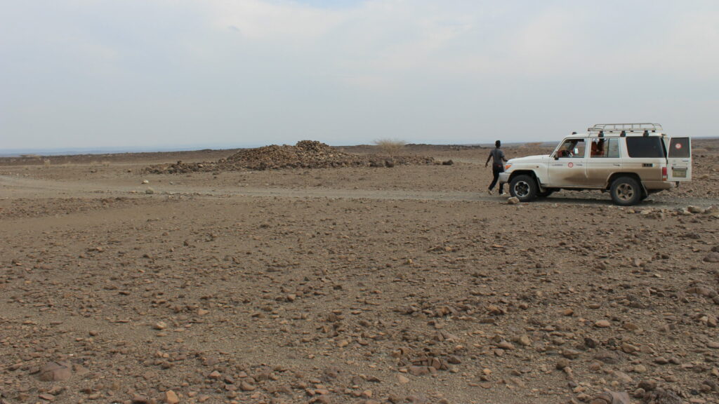
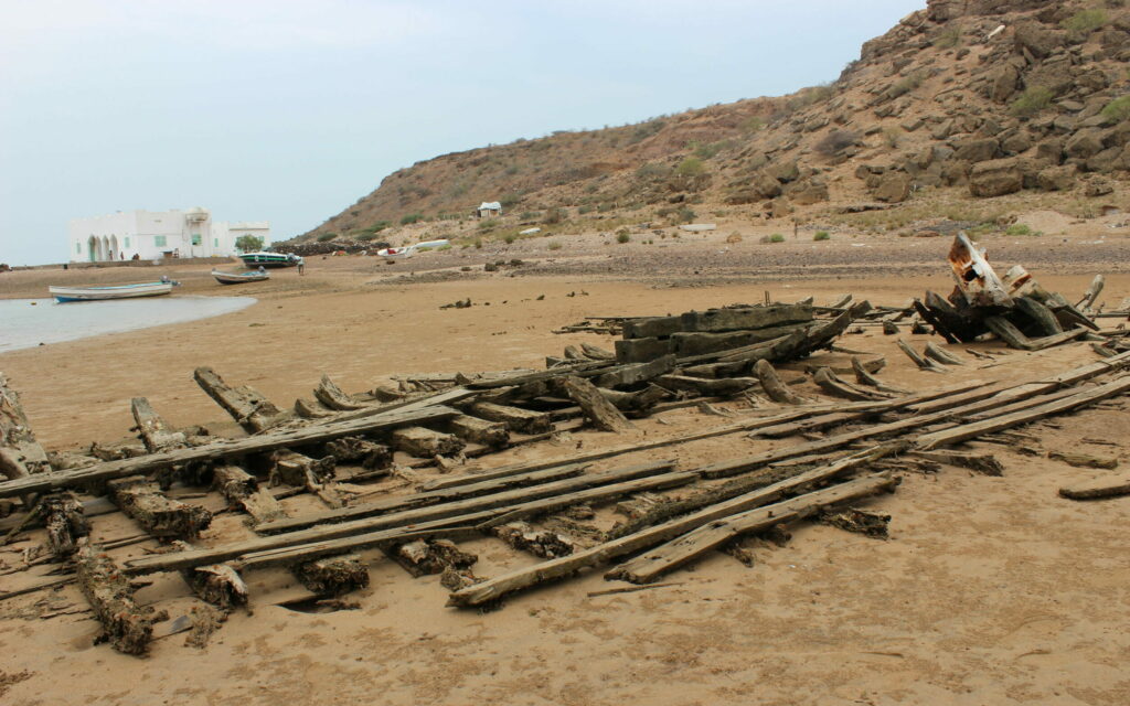
A third excursion was to the historically relevant coastal village of Raysali, from where the team followed the ancient and modern caravan route northwards with the help of a local guide. The bay of Raysali lies at the southern end of an extensive Quaternary alluvial fan complex, which opens to the south towards the Gulf and has its root at the mountains of the Mabla Basalt that connect to the north. Isolated reef limestones are present here (Figure 6), dating to the last interglacial (ca. 125 ka) (Le Gall et al., 2015). They prove a relative lowering of the sea level, either due to a former higher water level and/or tectonic uplift of the area. It is possible that this bay of Raysali was already used for landing in antiquity; at least some modern shipwrecks indicate a use as a landing place (Figure 7).
Figure 6: Exposed reef limestones in Raysali (Attribution & Copyright: K. Pfeiffer).
Figure 7: Recent shipwrecks in the bay of Raysali (Attribution & Copyright: K. Pfeiffer).
Summary and outlook
Due to the interdisciplinary orientation of the excursions (archaeology, geography, ethnohistory, history), various insights into the cultural landscape of Tadjoura could be gained. In the studied region, there are many, partly clearly diverging geological and geomorphological large-scale areas, which also differ from each other climatically through altitudinal zoning.
In addition to path systems and routes, the number and spatial distribution of tumulus complexes of different periods in particular indicate the social and cultural importance of the region as well as long lines of tradition. Geophysical soundings and the results of sediment dating planned for a further field visit are expected to provide important information on the ancient use of this cultural landscape.
We would like to thank the staff of the Centre d’Etudes et de Recherche de Djibouti (CERD), especially Saleh Zekaria, for the successful cooperation, his support of the project and his generous hospitality.
This website uses cookies to improve your experience while you navigate through the website. Out of these, the cookies that are categorized as necessary are stored on your browser as they are essential for the working of basic functionalities of the website. We also use third-party cookies that help us analyze and understand how you use this website. These cookies will be stored in your browser only with your consent. You also have the option to opt-out of these cookies. But opting out of some of these cookies may affect your browsing experience.
Necessary cookies are absolutely essential for the website to function properly. This category only includes cookies that ensures basic functionalities and security features of the website. These cookies do not store any personal information.
Any cookies that may not be particularly necessary for the website to function and is used specifically to collect user personal data via analytics, ads, other embedded contents are termed as non-necessary cookies. It is mandatory to procure user consent prior to running these cookies on your website.