The Linear Band Pottery Culture (the Linearbandkeramik or LBK) is an archaeological phenomenon with an immense geographic scope. The settlements in the western area of this culture have been studied very thoroughly and provide detailed knowledge about the spatial organization and settlement strategies of the early farmers in Central Europe. The knowledge about the eastern area of the LBK – the territory of today’s Ukraine, Moldova and Romania – is still rather limited compared to the regions of Central Europe. However, the eastern LBK sites offer an immense potential for new discoveries and for comparative studies on similarities and differences in material culture of the western and eastern LBK communities. Dmytro Haskevych, research fellow at the Department of the Stone Age Archaeology of the Institute of Archaeology, National Academy of Sciences of Ukraine, reports today on his current work on the systematic recording of LBK sites in Ukraine, which is basic for further research of this extraordinary phenomenon.
The beginning of the Neolithic in a large part of temperate Europe is associated with the diffusion of people of the Linear Band Pottery Culture, which area reaches the Paris Basin in the west and the outskirts of Kyiv in the east. Although the LBK is the most studied Neolithic culture in Central Europe, its sites in the territory of Ukraine are the least known to European researchers.
The most complete published list of Ukrainian LBK sites including 62 entities is presented by Olga Larina (1999). An unpublished catalogue comprising 108 sites is included in the PhD thesis by Olena Lenartovych (Krashanovych) of 2013. A number of new sites have been discovered in the last decade. However, due to the lack of publications and the language barrier, much old and new data remain unknown outside of Ukraine. My project aims at cataloguing and precisely mapping the LBK sites in Ukraine to approach current research gaps.
In the first step, I collected and reviewed records published in the last 100 years. These records (even the briefest and most uncertain) mention c. 400 locations of LBK materials, including accidental finds.
The next step involved a critical analysis of the obtained information and its verification based on field reports from the Scientific Archive of the Institute of Archaeology of the National Academy of Sciences of Ukraine. For this, I have also consulted with some other researchers. It turned out that some sites appear in publications and archival records under two or three (and sometimes more) different names. Some other ones had been mistakenly referred to LBK. As a result, the number of locations decreased to 275. About a two-third of them is undoubtedly attributed to LBK. Information on the other sites is incomplete or contradictory. It requires further verification in museum storages, regional agencies for heritage protection, or directly via field explorations. A distinct small group includes six sites of the local sub-Neolithic cultures, where “imports” of LBK pottery were discovered.
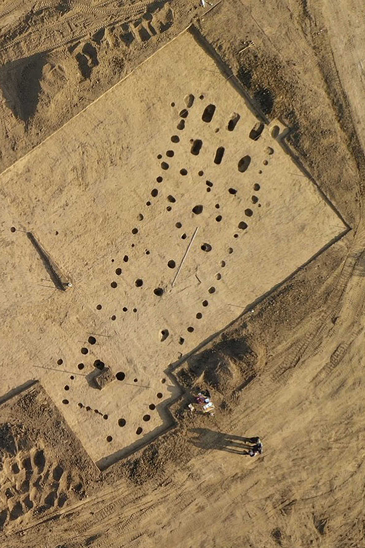
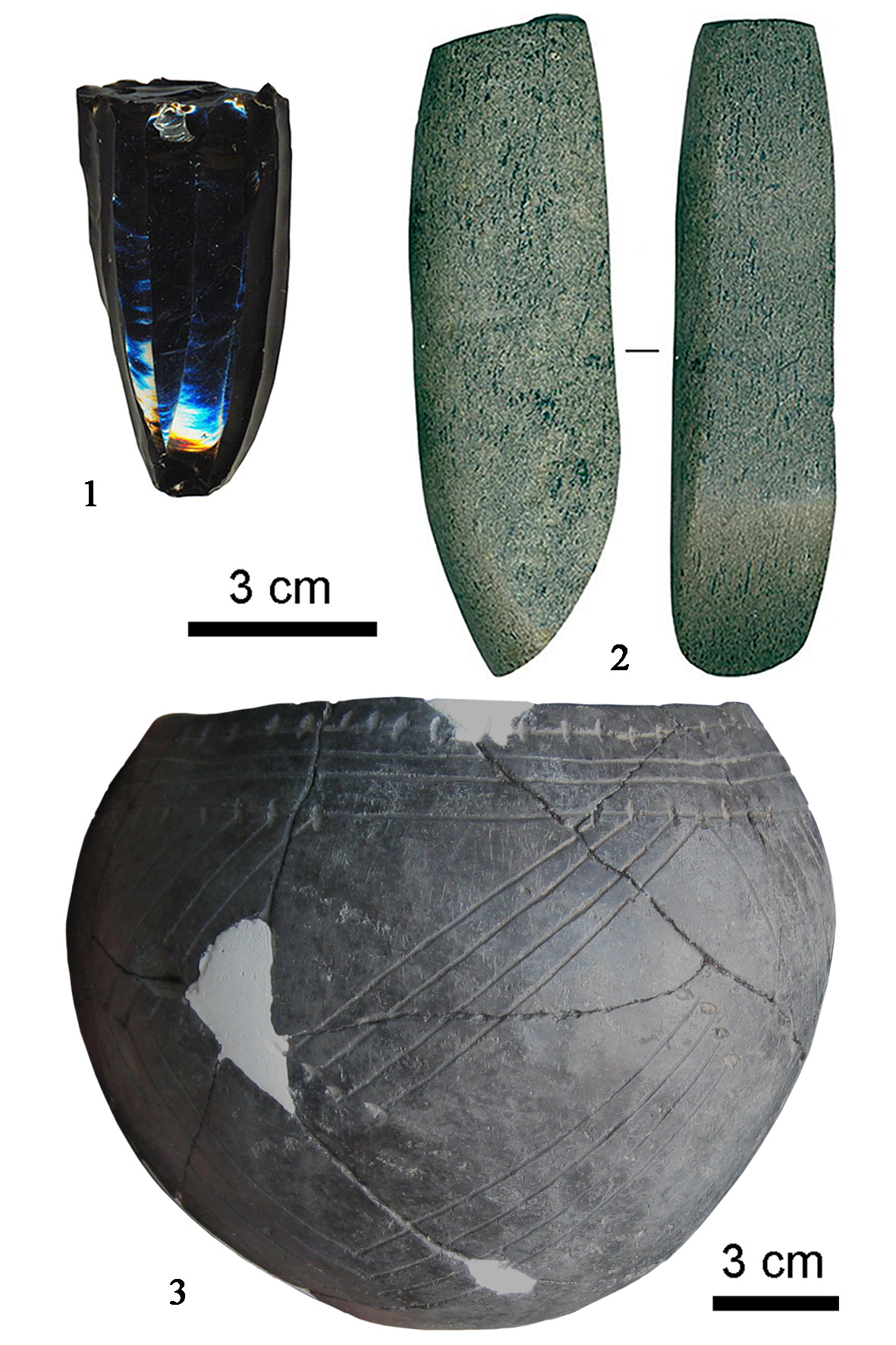
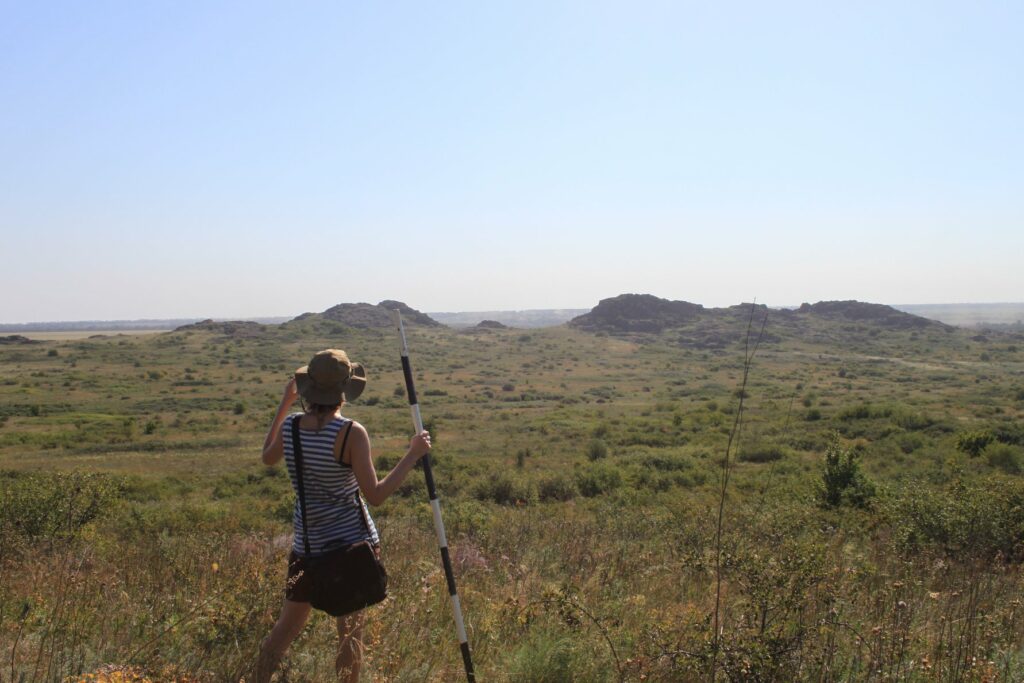
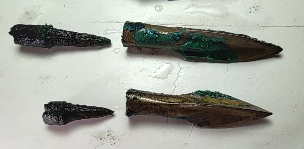
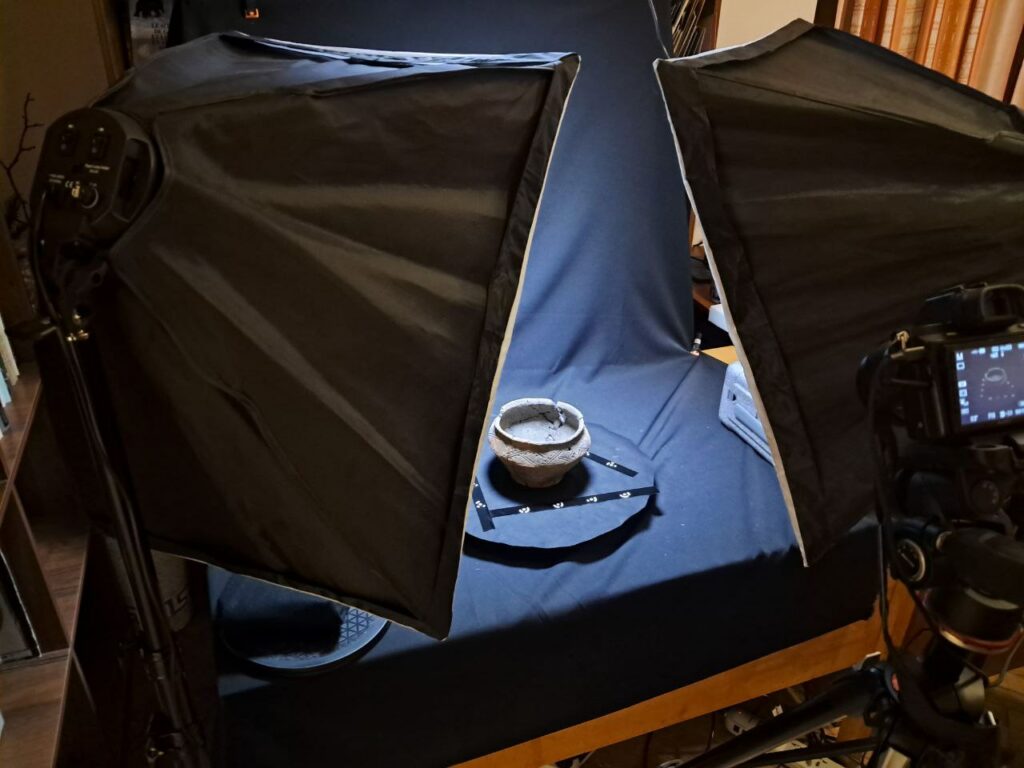
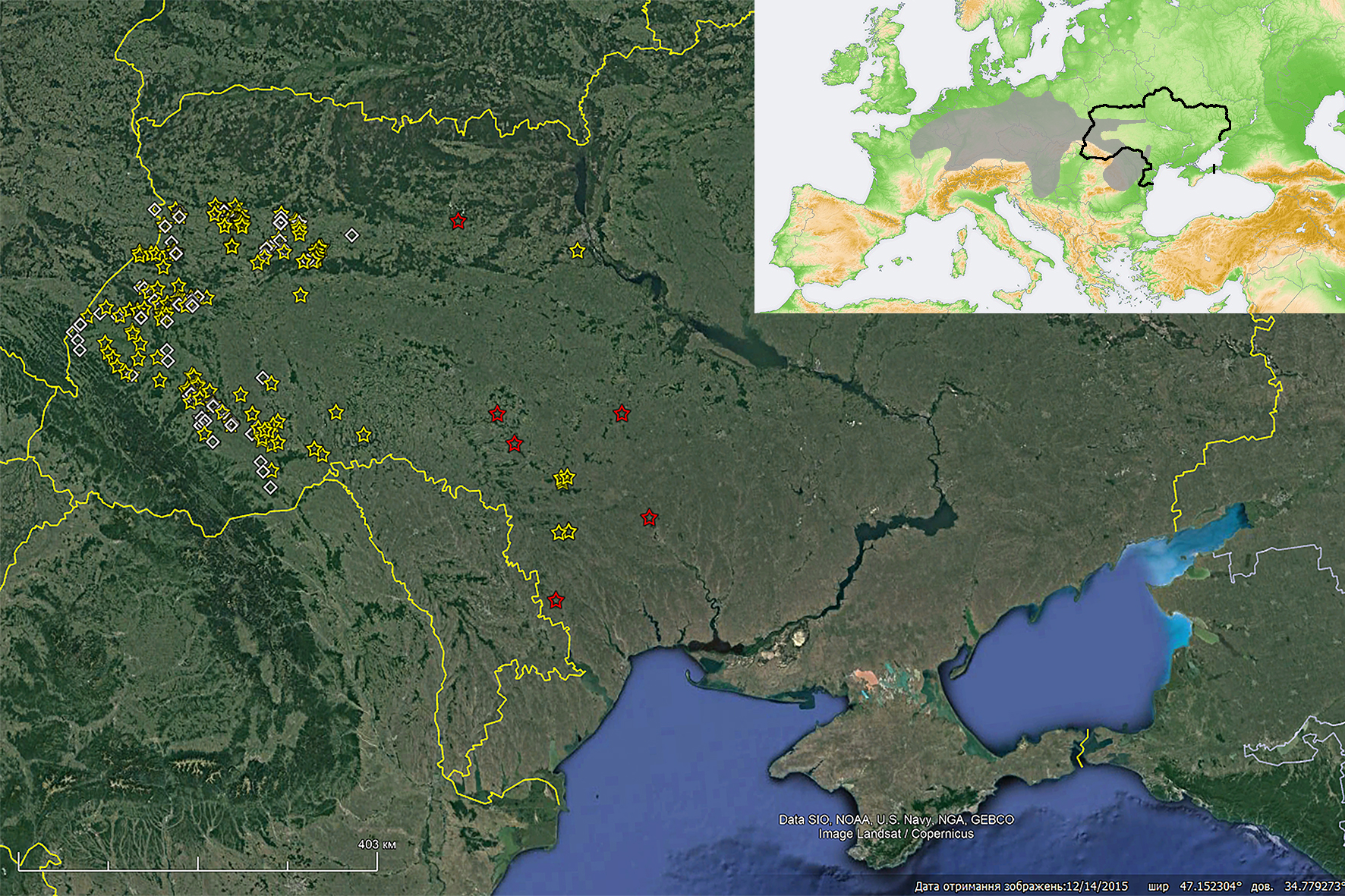
At the current stage, collected information about the sites is entered into a database designed as Microsoft Excel© 2016 spreadsheets. Site names (if necessary, including several different names for each site) are provided. The location of sites is recorded according to both the current (after 2020) and the past administrative divisions. The geographical locations are defined based on text descriptions, field plans and photos and are marked on aerial Google Earth© Pro photographs (Fig. 1). The coordinates and position of the sites relative to watercourses and landscape elements are recorded. Data on the history of discovery and research, site area and area of excavations are entered into the database (Fig. 2). The presence and number of features, potsherds, flint artefacts, and other finds are noted, as well as the information on radiocarbon dates and geophysical and natural science research (Fig. 3). References and comments accompanied each item.
At the final stage, the research results will be described and analysed in an article (supplemented with the database) published in a high-ranked international journal.
Dmytro Haskevych
References
Bardetskyi 2021: А. Бардецький, Рованці-Гнідавська Гірка – виняткова пам’ятка культури лінійно–стрічкової кераміки на Волині. Археологічні зошити з Пересопниці 8, 2021, 132–154.
Larina 1999: О. В. Ларина, Культура линейно-ленточной керамики Пруто-Днестровского региона. Stratum plus 2, 1999, 10–140.
Lenartovych 2013: О. В. Ленартович, Культура лінійно-стрічкової кераміки у басейні верхнього та середнього Дністра і Західного Бугу. Дисертація к. і. н. Інститут археології НАН України (Київ 2013).