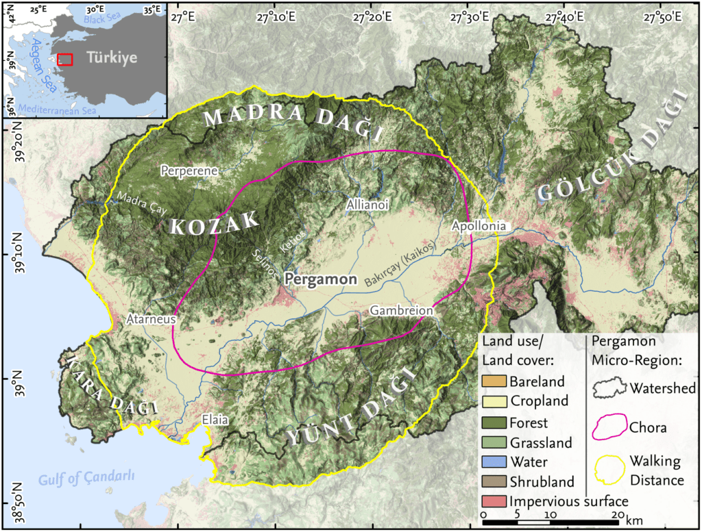
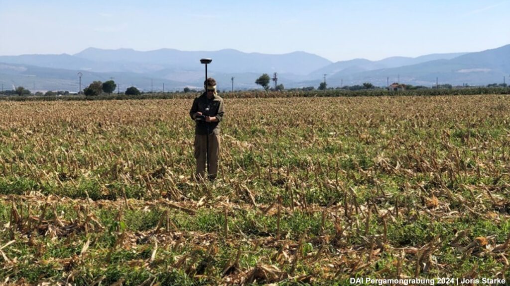
In August and early September, our survey team returned to the Pergamon Micro-Region to continue exploring the landscapes that shaped life between the city and the countryside. As part of the project Transformation of the Pergamon Micro-Region between the Hellenistic and the Roman Imperial Period, we aim to understand how Pergamon interacted with its surrounding countryside — e.g., through settlement, land use, cult, and infrastructure. This year’s campaign focused on the Selinus Valley stretching northwards into the Kozak Mountains, as well as the immediate surroundings of Pergamon in the area of modern Bergama at the transition between city and countryside.
Our work began north of the city hill of Pergamon along the ancient aqueduct. Here, we documented tumuli that extend the known necropoleis of Pergamon much further north than previously assumed (Fig. 1). This discovery adds a new dimension to the burial landscape around the city, suggesting a more extensive and integrated system than known so far.
We then shifted focus to the Selinus Valley, where we identified settlement remains and a Hellenistic watchtower that once controlled the crossroads between the latter valley and the Zarnacık Valley. Further west, on the slopes of the Geyikli Mountains, additional settlement traces were documented. In the higher elevations of the same mountains, we also recorded graves and settlement remains, offering new insights into how people settled and used the mountainous areas of the micro-region.
Among the many places documented this year, several sites stand out in particular:
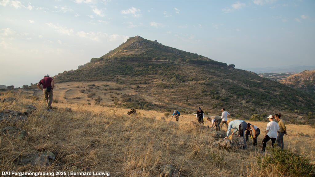
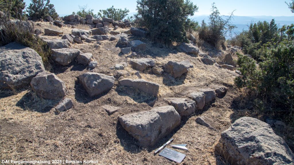
Fortress on Kurt Tepe: On a prominent hilltop, we documented the remains of a Hellenistic fortress with more elaborate architecture than a conventional watchtower (Figs. 2. 3). Stamped roof tiles bearing the inscription Basileion (royal) link the site directly to the Hellenistic rulers of Pergamon. Similar tiles were discovered last year in fortified sites east of the city. From Kurt Tepe, with its commanding view over Pergamon and the Bakırçay (Kaikos) plain, the presence of Attalid power in the surrounding landscape becomes especially tangible.
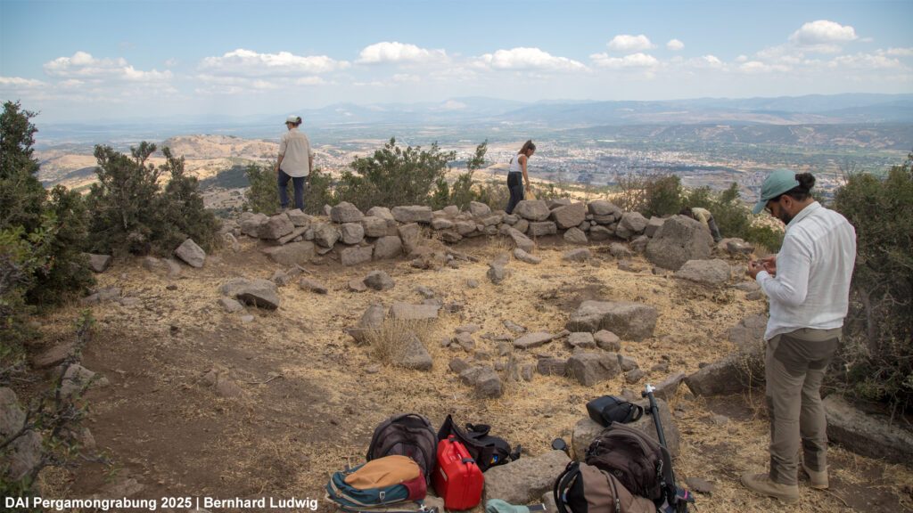
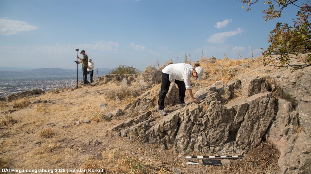
Farmstead near Kurt Tepe: On a plateau beneath the fortress, we found the remains of a farmstead (Fig. 4). Architectural traces, press weights indicating agricultural production, and a rock-cut niche point to a close intertwining of farming, economy, and cult practice at this site.
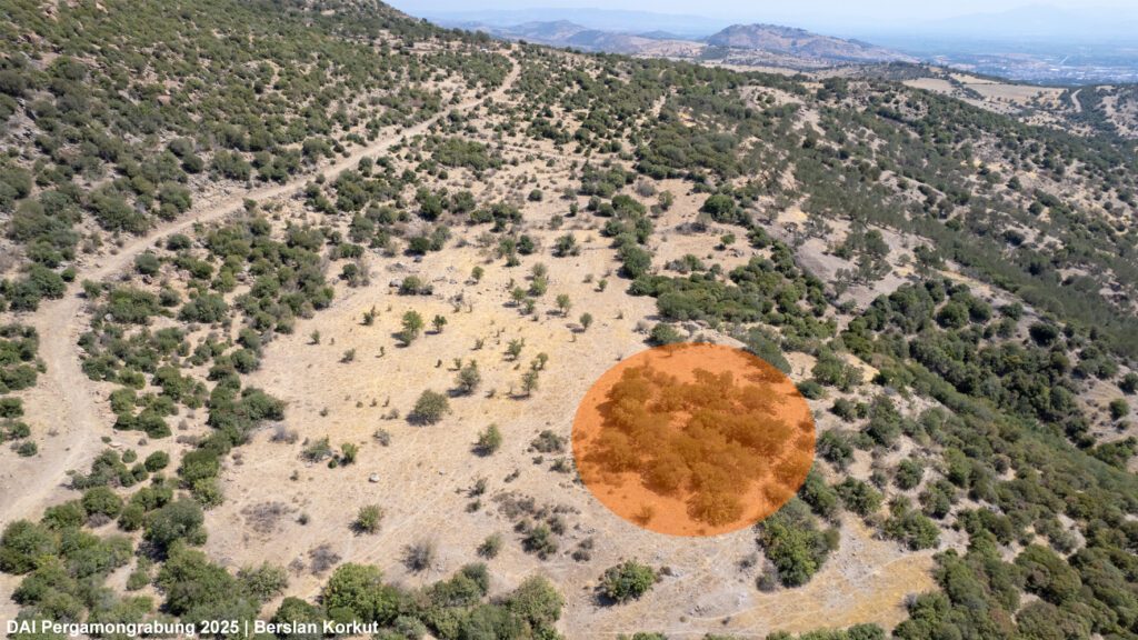
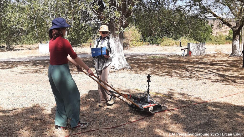
Large Roman Site east of Pergamon: The remains of a substantial Roman-period complex were identified about 3 km east of the city. Roof tiles, ceramics, and numerous marble fragments suggest a richly equipped estate with elaborate architecture, located in the immediate vicinity of Pergamon. Geophysical surveys are currently underway to gain a clearer picture of the extent and layout of this complex (Fig. 5).
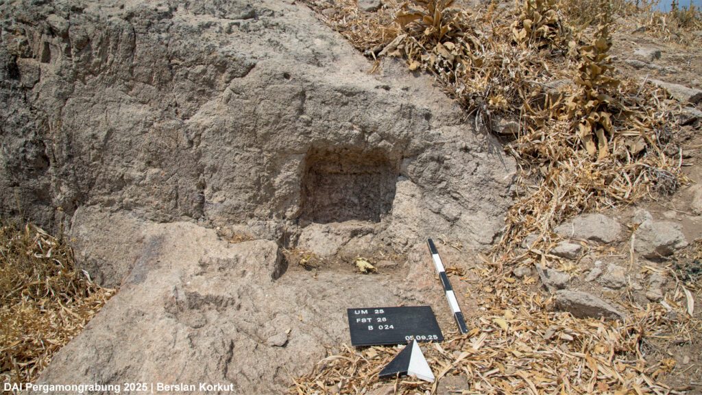
Ilyas Tepe: This prominent hill east of Pergamon was systematically surveyed for the first time (Fig. 6), following earlier rescue excavations and excursions. The investigations revealed a large cult complex with rock-cut niches (Fig. 7) and buildings, set in a landscape also marked by quarrying activities. The relationship between cult practices and quarrying remains an open question for further study.
Working in the summer heat and navigating steep slopes was not without its challenges, but the reward was a much clearer picture of how the city of Pergamon was embedded in its wider landscape. From burial grounds and farmsteads to fortresses, estates, and cult sites, this year’s results highlight the diversity of rural life and the many ways in which the countryside was shaped by — and in turn shaped — the city.
The evaluation of the documented sites and finds is ongoing, and preliminary results will be published in the next Vorbericht in the series Archäologischer Anzeiger.
For anyone interested in learning more about this year’s fieldwork or getting in touch with the team, please use the contact form available on this blog.