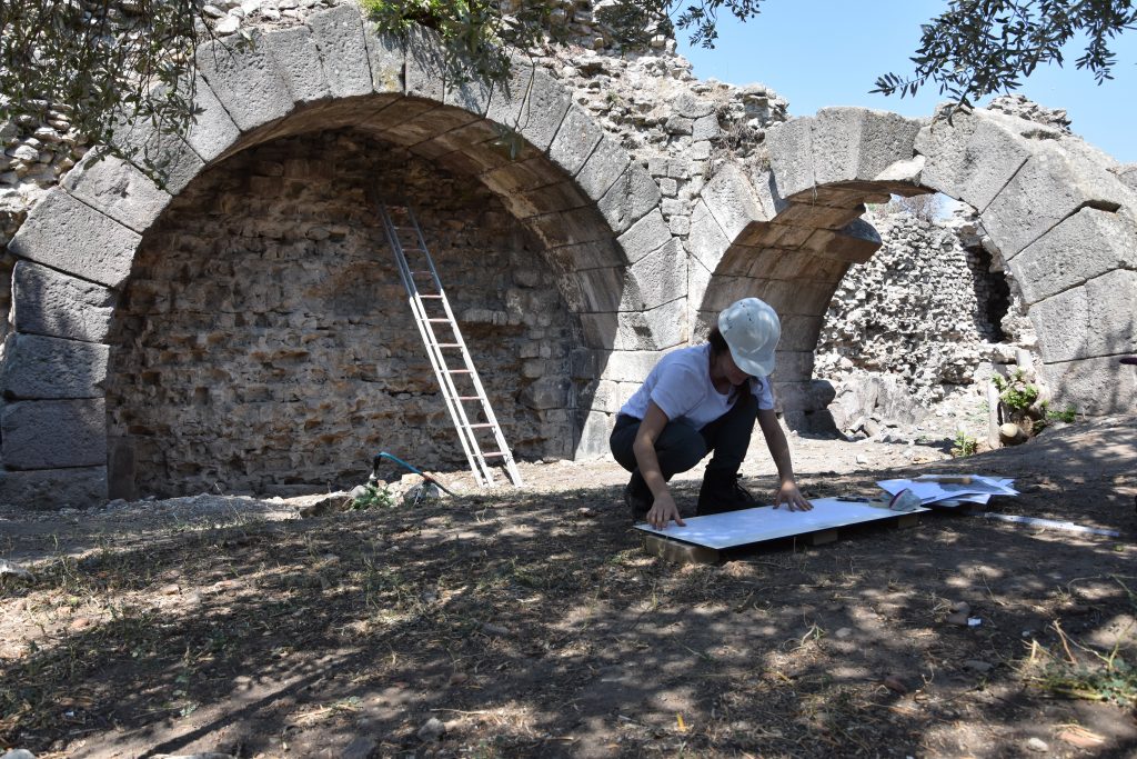
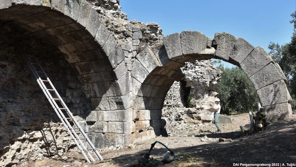
The ruins of the so-called Lower Western Gymnasion of Pergamon are located east of the Selinus River at the foot of the city’s western slope within the boundaries of the Hellenistic city. Only a few wall structures of the building have been preserved. These structures are the only traces left of a large building from the Roman Imperial Period, oriented north-south and possibly extending to the bank of the Selinus River. The best preserved part runs along the modern Eski Kozak Caddesi with a length of about 20 meters and is structured by niches and round arches.
When reading travel and research reports of the past centuries one can notice that this complex has hardly been the subject of an in-depth research. Marie-Gabriel-Florent-Auguste de Choiseul-Gouffier was the first to mention “the ruins of a huge building that may have been the gymnasion” in 1782 in Voyage Pittoresque de la Grèce. Drawings from 1908 by Paul Schazmann are the only detailed documentation we have to this date.
The aim of year’s fieldwork, which was carried out within the scope of the TransPergMikro project, was to document the remains of this building in detail and to retrace the building process. Furthermore, the connection between the remains which run along the modern street and some still preserved structures in the immediate vicinity of the Selinus were investigated. The question was also addressed as to whether the Lower Western Gymnasion was part of the alleged construction program of the Amphitheater and/or the Roman Theater.
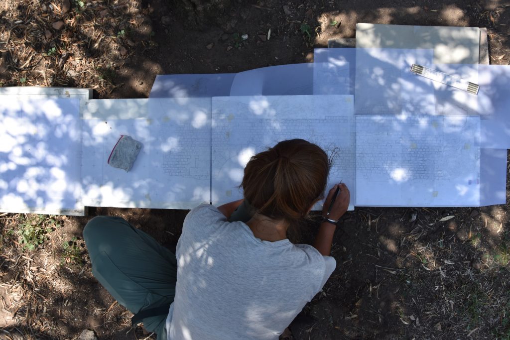
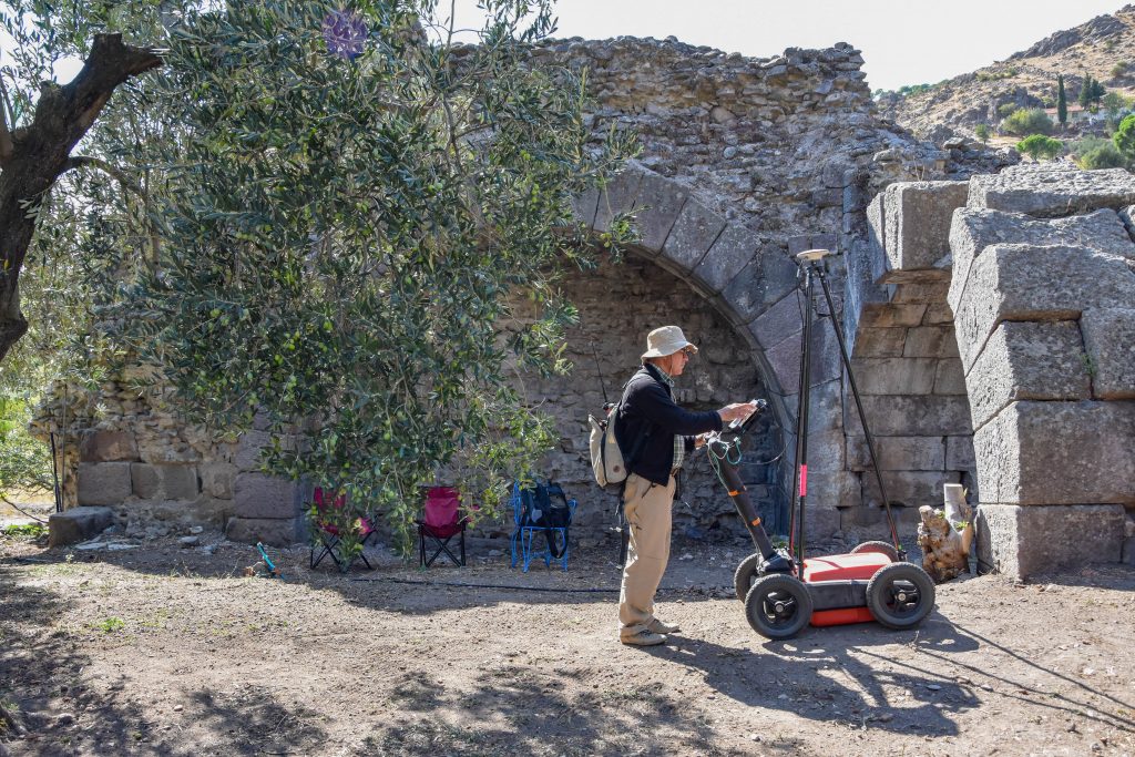
In order to start an accurate and detailed construction survey, vegetation around the building needed to be removed, which was possible thanks to the good cooperation with the owners. After having made the structure visible and accessible, the documentation process began, first with photos, sketches and short descriptions. One of the most important steps in the documentation process was the generation of a 3D model, which was created using the Structure from Motion (SfM) technique. The model served, in combination with tachymetric measurements, as the basis for drawing the elevations, the sections and the ground plan in scale 1/20. Materials and damage mappings will also be part of the ongoing project. Geophysical surveys were also conducted to locate possible additional walls and determine the extent of the building.
Fieldwork at the so-called Lower Western Gymnasion will continue until the end of the 2021 campaign in Pergamon and hopefully provide further insights into urban development in this area of the city.