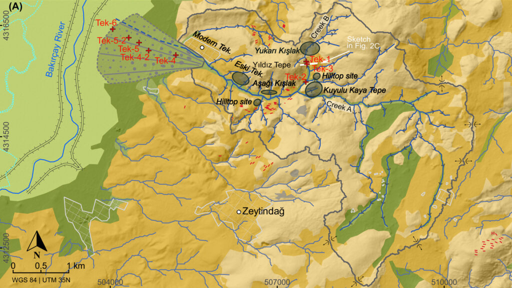
Since 2019, a German-Turkish team of the DFG-funded TransPergMikro project on the “Transformation of the Pergamon Micro-Region between Hellenism and the Roman Imperial Period” has been investigating selected areas in the vicinity of Pergamon. This year, the team focused mainly on the transition zone between the eastern foothills of the Kara Dağı (Kane) peninsula and the western lower Bakırçay (Kaikos) plain. During the six weeks of field work, numerous new sites were discovered and documented, expanding our knowledge of the settlement structure and history of the Pergamon Micro-Region as well as of past human-environment interactions.
At Deliktaş, a probably Achaimenid-Hellenistic fortress could be documented on Zindan Tepe (Fig. 1). Location and structure of the site resemble the seats of local rulers or dynasts, as they are assumed for the micro-region in classical times. The complex was almost completely cut out of the rock, preserving not only rooms connected by stairs, but even bathing facilities (Fig. 2). In the immediate vicinity of this site, which was probably already inhabited in the Bronze Age, several (already robbed) burial mounds, a grave monument, and the remains of several rock tombs were discovered.
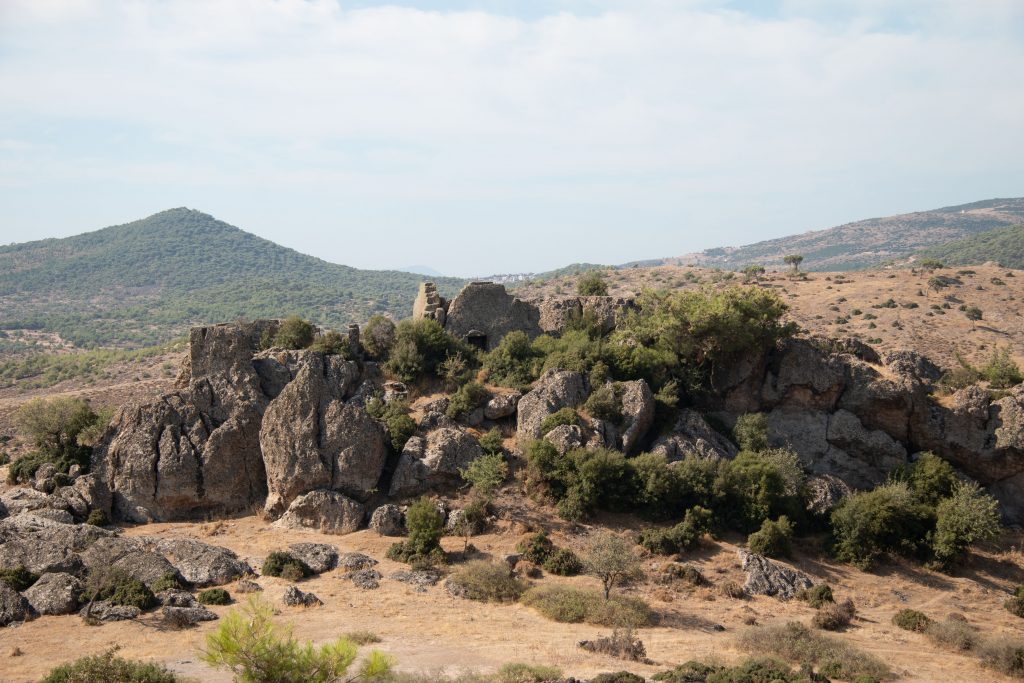
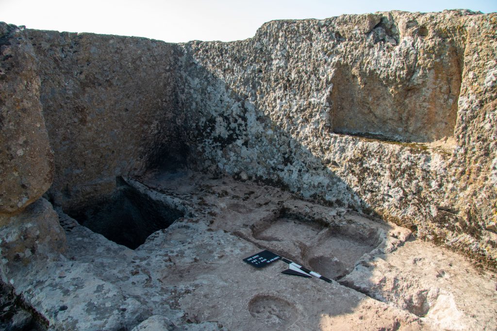
Fig. 2 Bathing facilities on Zindan Tepe (DAI Pergamongrabung 2021 | B. Ludwig)
On the peaks and ridges of the eastern Kara Dağı Mountains, extensive research has uncovered further remarkable sites. A fortress from the Classical-Hellenistic period is dominating the eastern Kane peninsula. The site has an impressive view over the western lower Bakırçay plain and to Pergamon, Elaia and Pitane. On the approximately 110 x 60 m summit, the collapsed defensive wall and a central building can still be seen today (Fig. 3).
On less elevated hills on the Kane peninsula, the team was able to discover two other fortified sites that, at the current stage of finds processing, are dated primarily to the Classical and Hellenistic periods. Each of them consists of a central main building protected by a surrounding wall. Similar sites have been discovered during previous expeditions and research in the Kara Dağı Mountains and are usually interpreted as either watchtowers or so-called tower houses (“Turmgehöfte”) as part of an agricultural estate. Worth mentioning at the two newly discovered sites are inscriptions carved in stone with the letters “OB” (Fig. 4). While the “O” is interpreted as ὅ(ρος) = boundary stone or marker, the “B” does not match any known site in the area. Further evaluation and study of the written sources will possibly provide us with further answers as to which settlement the border guards who monitored this land belonged to.
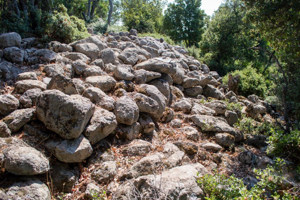
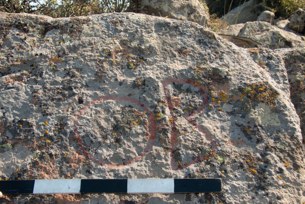
Fig. 4 Inscription “OB” highlighted in red (DAI Pergamongrabung 2021 | B. Ludwig)
On Emirali Tepe, a hill on the western edge of the Bakırçay plain at the transition to the Kara Dağı Mountains, the team found another fortress dating from the Classical to the Roman Imperial Period (Fig. 5). It is situated on several terraces and plateaus and surrounded by a 900 m long defense wall. Particularly impressive are the high-quality polygonal masonry of the terrace and fortification walls as well as the high-quality architecture of the summit with marble and mosaics (Fig. 6). These were possibly built under Attalid rule as a manifestation of territorial claims.
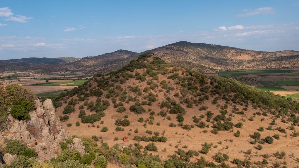
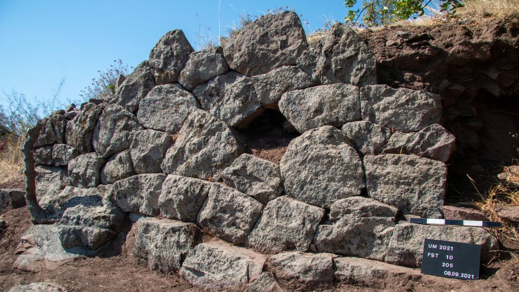
Fig. 6 High-quality polygonal masonry on Emirali Tepe (DAI Pergamongrabung 2021 | B. Ludwig)
More than 150.000 finds were documented on fields in the western lower Bakırçay plain (Fig. 7). Among them was a large amount of wasters, overfired pieces, stacking devices and kiln slags as evidence of production manufacture. The collected finds, which are currently still being processed, provide evidence of pottery production from the Roman Imperial period to Late Antiquity with a focus on amphorae, bowls and possibly jars and a range of types that is largely unknown in the region so far (Fig. 8). Further evidence was provided by geophysical surveys conducted alongside the archaeological survey. The team from the universities of Kiel and Kocaeli was able to detect up to ten anomalies, which are related to pottery kilns. Their position coincides with the concentrations of production manufacture that was mapped on the surface. In addition, the survey team was able to identify numerous marble fragments of various provenances, attesting to an elaborate architecture at this remarkable site in the Pergamon Micro-Region. The combination of lavish architecture and pottery production reminds of a site close to Bozköy, where we assume a Roman Villa, which could offer fascinating insights in the sources of income of Pergamon’s elite during the Roman Empire.
The archaeological survey team also worked together with the geophysicists at a presumed villa complex near Sindel, a Roman villa near Bozköy, and a thermal bath near Kiroba-Mazılı. This fieldwork was completed a few days ago and the detailed evaluation of the discovered sites has just begun. We therefore expect to report further insights and details in the near future.
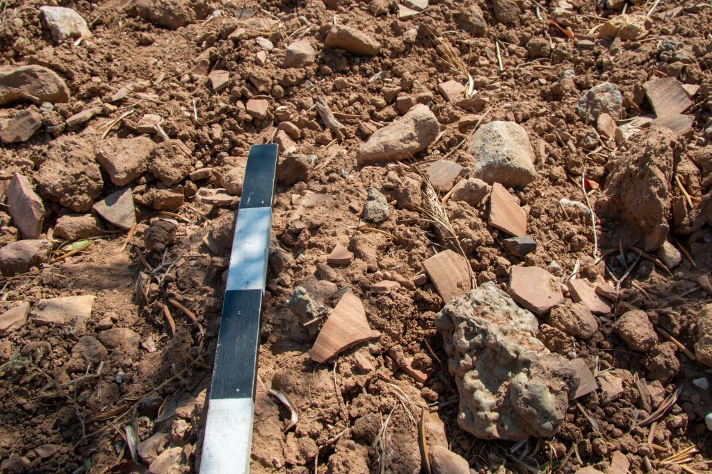
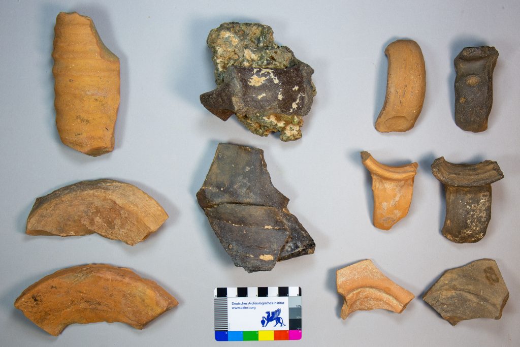
Fig. 8 Random selection of finds as evidence of pottery production (DAI Pergamongrabung 2021 | A. Günzel)