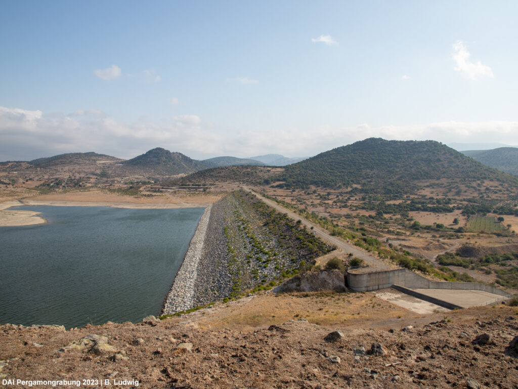
The Archaeological Survey in the Pergamon Micro-Region often takes us to places where history and present collide. This was especially true during this year’s survey. As part of the TransPergMicro project, the Turkish-German survey team explored the eastern lower plain of the Bakırçay river (ancient Kaikos) and the southern Madra Dağı Mountains around ancient Parthenion – an ancient landscape that has been affected by massive land consolidation, the construction of dams and quarrying activities in recent decades (Fig. 1). Nevertheless, we were able to make many new discoveries and after 6 weeks of fieldwork we can tell a story of transformation and rediscovery. Here are first glimpses of our newly uncovered sites and preliminary results.
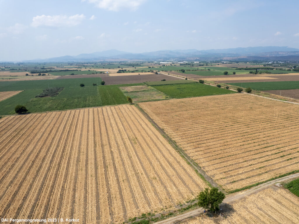
Today, the eastern lower plains of the Kaikos River are characterized by large corn and cotton fields, straight roads, and few small villages. Only the surrounding mountains of the Yunt Dağı and Madra Dağı Mountains serve as orientation in the otherwise flat landscape. As a result of our survey and thanks to information from the local community, we now know that many small streams made their way to the Kaikos River in the past, buffalo herds were kept in the extensive wet and swampy areas, and many hills provided orientation and were used as settlement sites in prehistoric and ancient times.
The most prominent example is Üyücek Hill, which has miraculously been spared from land consolidation and the leveling of fields (Fig. 2). Today the hill is still about 15 m high and has a diameter of about 100 m at the base. The oldest pottery collected during our systematic survey probably dates to the Chalcolithic and Bronze Ages. Evaluation of finds, however, is still in its early stages. A rural settlement also appears to have existed on Üyücek from Archaic times to the late Hellenistic or early Roman Imperial periods. Geophysical surveys by the Universities of Kiel and Kocaeli have also provided evidence of presumed building structures on and around the hill.
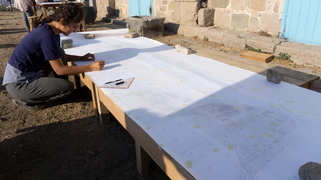
Despite land consolidation, we were also able to discover the remains of a rural Late Hellenistic to Late Antique settlement in the fields on the outskirts of the village of Zağnos (Fig. 3). The dense find scatter of pottery and brick fragments that we were able to map on the surface coincides with the location of the anomalies of the geophysical surveys. According to this, the settlement was at least 80 x 140 m in size. However, further parts of the settlement could also lie under the small village of Zağnos, where the walls of the mud-brick houses contain many ancient ceramic fragments. An agricultural function of the site in antiquity could be traced by the counterweight of a large press.
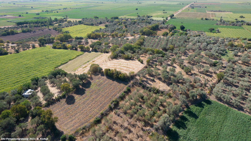
Fig. 3 (right) Intensive pedestrian survey in the fields on the outskirts of the village of Zağnos
The remains of the Soma water pipeline’s aqueduct were previously known to us on the eastern side of the Yortanlı valley (Figs. 4-5). This year, our documentation of newly discovered remains on the west side of the valley have led to a more comprehensive understanding and provided a detailed insight into this extraordinary construction. With a reconstructed height of about 40 m and a length of about 550 m, it is one of the largest Roman aqueducts in the ancient world. This structure raises questions about the immense resources, labor and time invested in its construction. It becomes a window into the socioeconomic dynamics of the time and provides insight into how the landscape was shaped over many years. This coincides with the core themes of our project, in which we are looking, for example, at the economics of construction or the efficient use of resources.
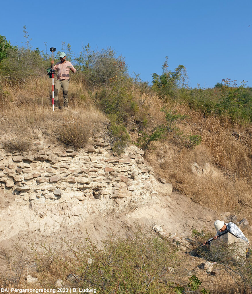
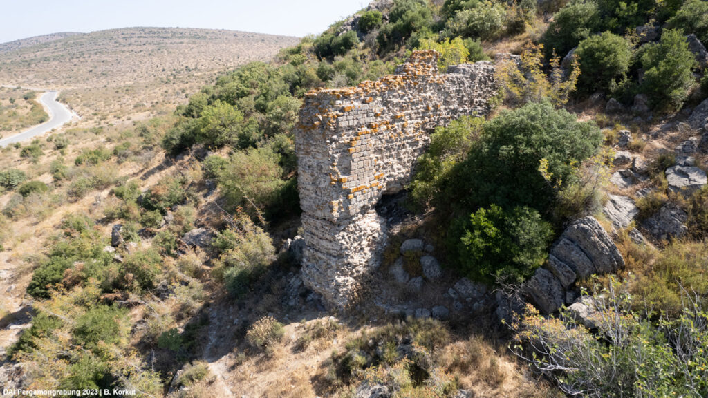
Fig. 5 (right) Already known section in the east
During the survey, our focus turned to the barely explored Hisarlık Tepe, a prominent hill long believed to be the site of the ancient Parthenion (Fig. 6). However, the documented remains of a fortification wall and numerous buildings, along with the collected pottery, predominantly date from the (late) Byzantine period. Notably scarce are findings from the Classical and Hellenistic periods, which questions the traditional attribution of the Polis Parthenion to Hisarlık Tepe. Instead, the newly discovered site on neighboring Çamlıyatak Tepe should be included in the discussion.
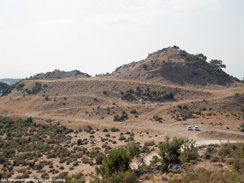
Çamlıyatak Tepe is a steep hill, which has been used as a quarry for the construction of the Çaltıkoru and Yortanlı dams (Fig. 7). Although two-thirds of the hill have been removed, we were able to document remains of the former Classical-Hellenistic settlement on the preserved slopes. Especially the pottery from the Classical period is of excellent quality. In the surrounding area we also discovered several tumuli and rock tombs as well as a another smaller fortress from that period. Our survey thus provided numerous new insights for the area and forms the basis for new historical-geographical considerations on the location of ancient Parthenion.
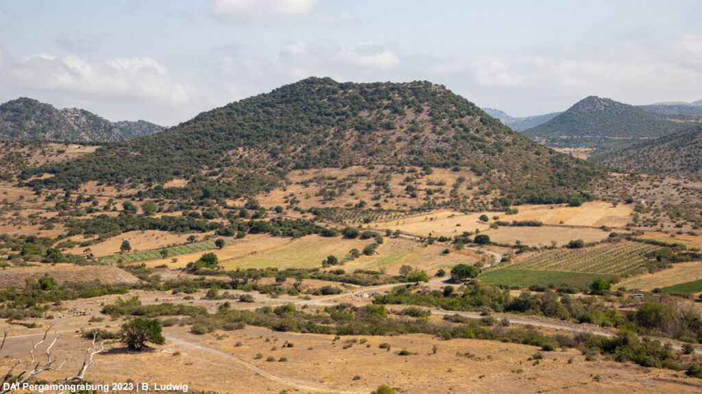
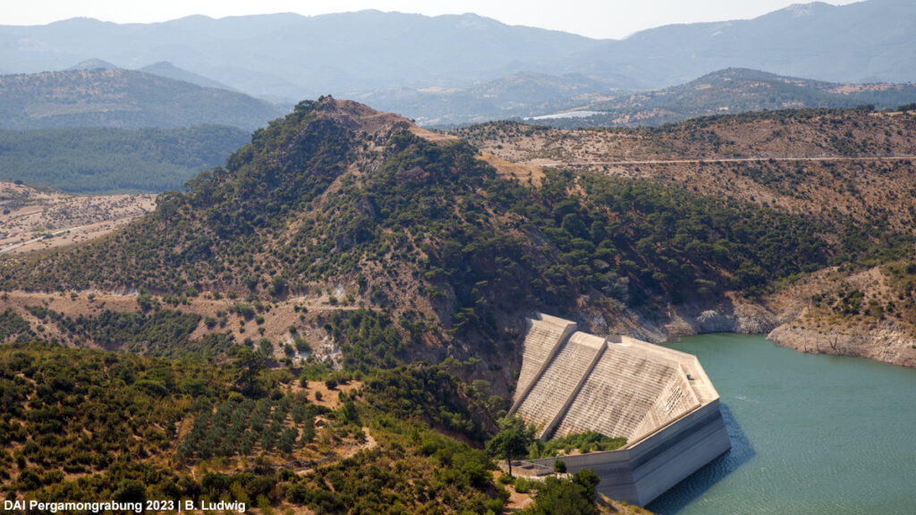
Fig. 7 (right) Çamlıyatak Tepe
After 6 weeks of fieldwork in the eastern Pergamon Micro-Region, we can say: Although much archaeological evidence has probably been lost due to the alterations of the landscape in recent decades, it is not too late for discoveries that will expand our knowledge of ancient Pergamon and its surroundings. Through our fieldwork, we have been able to document many previously unknown sites east of Pergamon, which at the same time provide new input and ideas for different parts of our project. Now it is time to evaluate the results in detail.
– – –