Ida Luise Rewicki & Yannic Grohmann
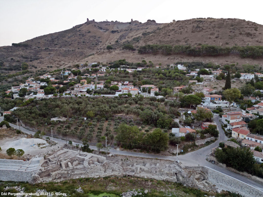
Following the Bergama Çayı (ancient Selinus) upriver from the Roman Imperial ‘Red Hall’, one immediately spots Bergamas substantial construction project of a new river embankment commissioned by the Devlet Su İşleri (DSİ; General Directorate of State Hydraulic Works). In an area situated to the north-west of Bergamas old mosque, the newly built river embankments border on an undeveloped area. Here, ancient structures have been discovered during construction work. Between 2021 and 2023 the Bergama Müzesi carried out excavations to determine the extent of the walls and buildings. Today, the ancient city’s remains can be seen over an area of almost 1 km², the oldest of which date back to the Hellenistic period. In cooperation between the DSİ, the State Monuments Authority in İzmir (2. Nolu Kurul), the Bergama Müzesi, and the Pergamon Excavation Project, the area has been preserved in order to be documented as part of the authors’ master’s thesis. The documentation of Pergamon’s urban riverbank in this area is carried out by the Department of Historical Building Research and Monument Preservation at the Technical University of Berlin as part of the TranPergMicro project.
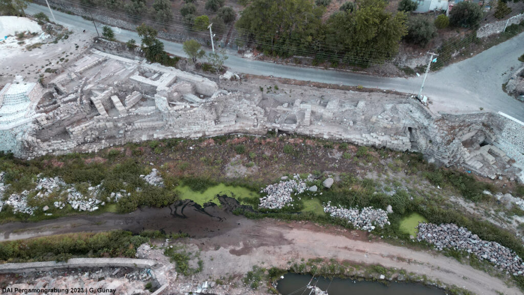
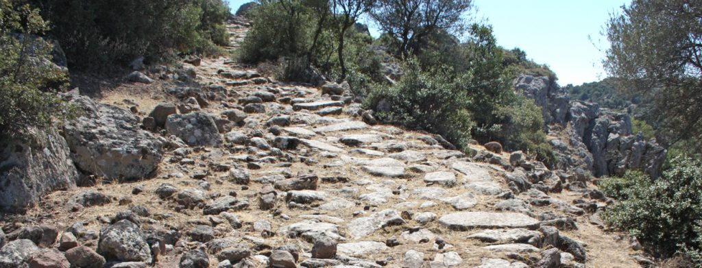
The first reference to ancient structures on the riverbank of the Selinus, made by French archaeologist Charles Texier, date from the 19th century. He described quay walls as well as bridges connecting the riversides. One of these bridges is the ‘Kazancı Köprüsü’, which borders on the area of research. In the early 20th century Wilhelm Dörpfeld examined the bridge, which had been destroyed by that point (Dörpfeld 1908). Half a decade later, Alexander Conze published a description of a polygonal wall on the riverbank of the Selinus (Conze 1913). Almost a century later, in 2011, an excavation by the Bergama Müzesi revealed further building remains for the first time. Two years later, the bridge was studied with the methods of building research by Erik Wegmann (Pirson 2013, 2014), who identified several building phases of the bridge. The recent construction works have again increased the number of known structures as well as the total area of research. The structures stretch from the bend in the river in the west to the remains of the ‘Kazancı Köprüsü’ in the east, as well as from the river up to the modern street running parallel to it.
Unique features of the area include systems for water management on at least three different elevation levels. The lowest level, which stretches the entire length of the site, is an artificial river embankment. Some of the structures on the intermediate level can be considered terraces. Drainage systems can also be identified in the form of street-level gutters as well as underground channels and clay pipes. On the uppermost terrace, there is evidence of urban buildings.
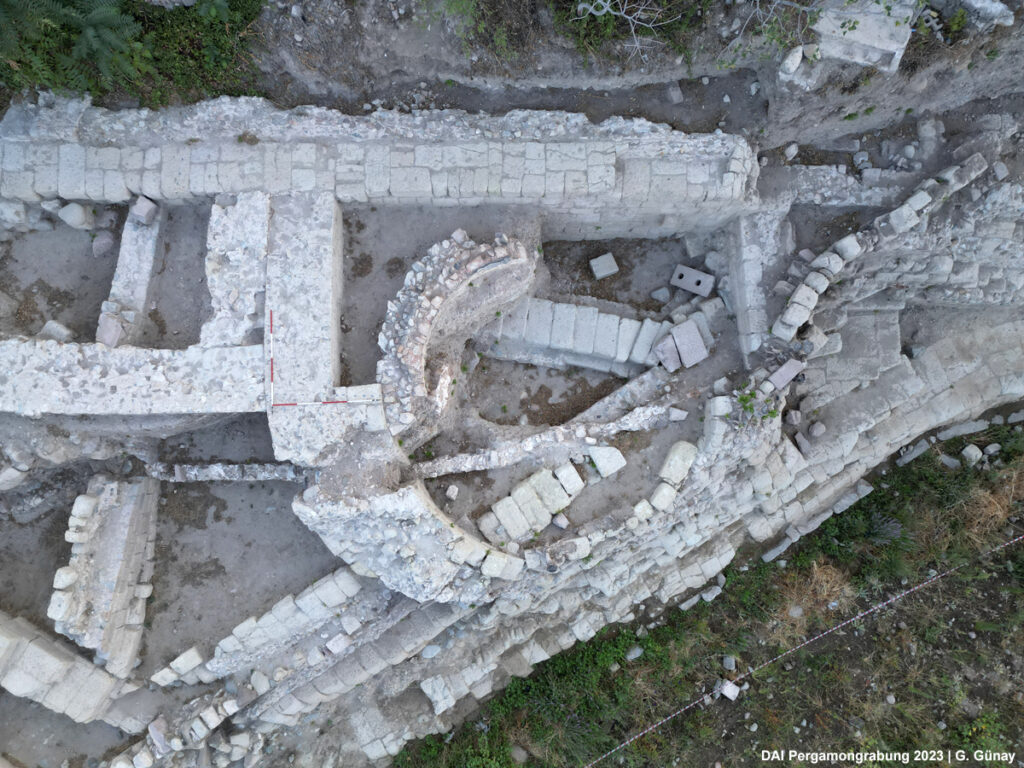
So far, two main phases of building activity can be identified: The first is an artificially constructed river embankment combined with representative architecture such as a presumed nymphaeum, while the second represents a reuse of the area for craft purposes in late antiquity.
This master’s thesis aims to compile a detailed documentation of the site and to identify absolute construction phases and construction techniques. In terms of urban development, the unique location of the area between the foot of the city hill and the area of Roman expansion to the southwest with buildings such as the amphitheater and the stadium will also be examined. The results will hopefully advance knowledge about the development of the city between Hellenistic and Roman settlement and answer questions about the interaction between humans and the natural environment.
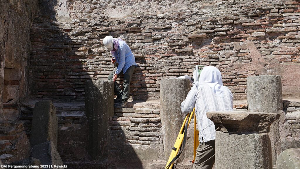
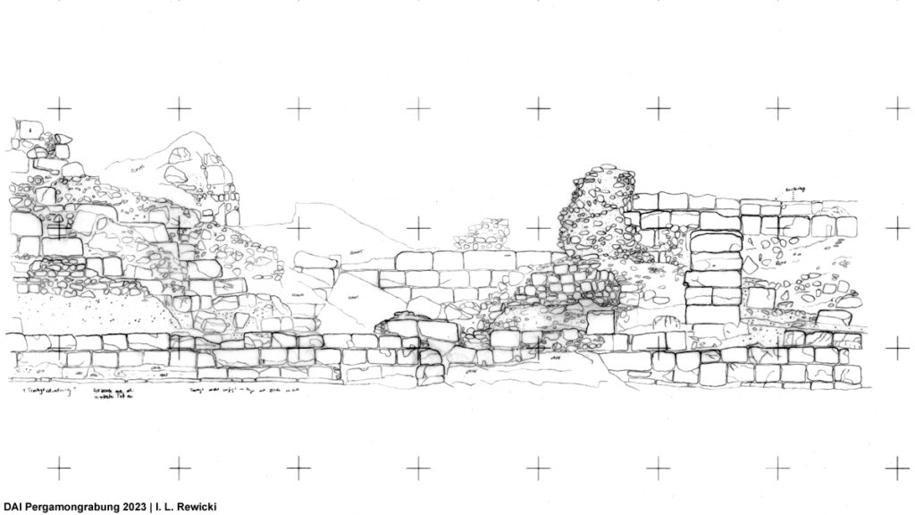
Surveying the site in the highest grade of detail will facilitate the methodological approach. The documentation includes a top view and several sections, firstly modeled from ‘Structure from Motion’ in combination with totalstation measurements and consequent manual drawings consolidated by measurements made on-site. Supplementation in the form of photographic and written reports of each individual wall are also part of the process. Plans of relative construction phases will aid in better understanding relations between the structures and possibly uncover functional aspects.
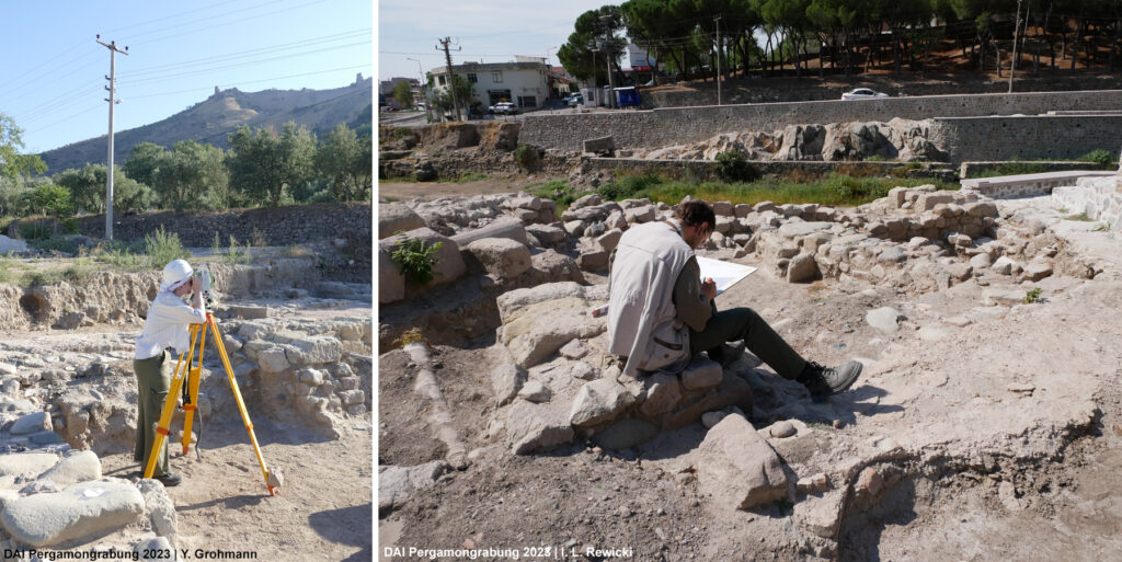
Fig. 5 (right) Architectural documentation on-site.
During the 2023 campaign, documentation and manual drawings had been the primary focus of the work on-site. Currently, phases of construction and repairs are being investigated. The aim is not only to reconstruct some of the structures found on site, but also to draw conclusions about the general use of the site in different periods. The conclusions from this ongoing master’s thesis will contribute to a better understanding of the interaction between the city and the Selinus River, especially during the Roman Imperial period, and thus promote understanding of some of the questions addressed by the TransPergMicro project.
References
Dörpfeld 1908
Dörpfeld, Die Arbeiten zu Pergamon 1906–1907, Mitteilungen des Deutschen Archäologischen Instituts, Athenische Abteilung 33, 1908, 328-374
Conze 1913
Conze, Stadt und Landschaft, Altertümer von Pergamon 1, 2 (Berlin 1913)
Pirson 2013
Pirson, Pergamon. Bericht über die Arbeiten in der Kampagne 2012, Archäologischer Anzeiger 2013/2, 79–164
Pirson 2014
Pirson, Pergamon. Bericht über die Arbeiten in der Kampagne 2013, Archäologischer Anzeiger 2014/2, 101–176