Sea level evolution and climate change from 5500 BC until AD 2100
The Madrid Department of the DAI and the Ampurias/Empúries branch of the Archaeological Museum of Catalonia / Museu de Arqueología de Catalunya – Empúries (MAC-Empúries) (L’Escala, Catalonia, Spain) have been carrying out joint projects for several decades. Since 1994, these have included geoarchaeological investigations that have documented major changes in the coastal landscape during the Holocene and provided clues for the reconstruction of Greek, Roman, and Iberian territories. Further results were produced by the University of Barcelona and Geoservei.
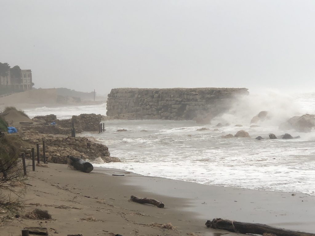
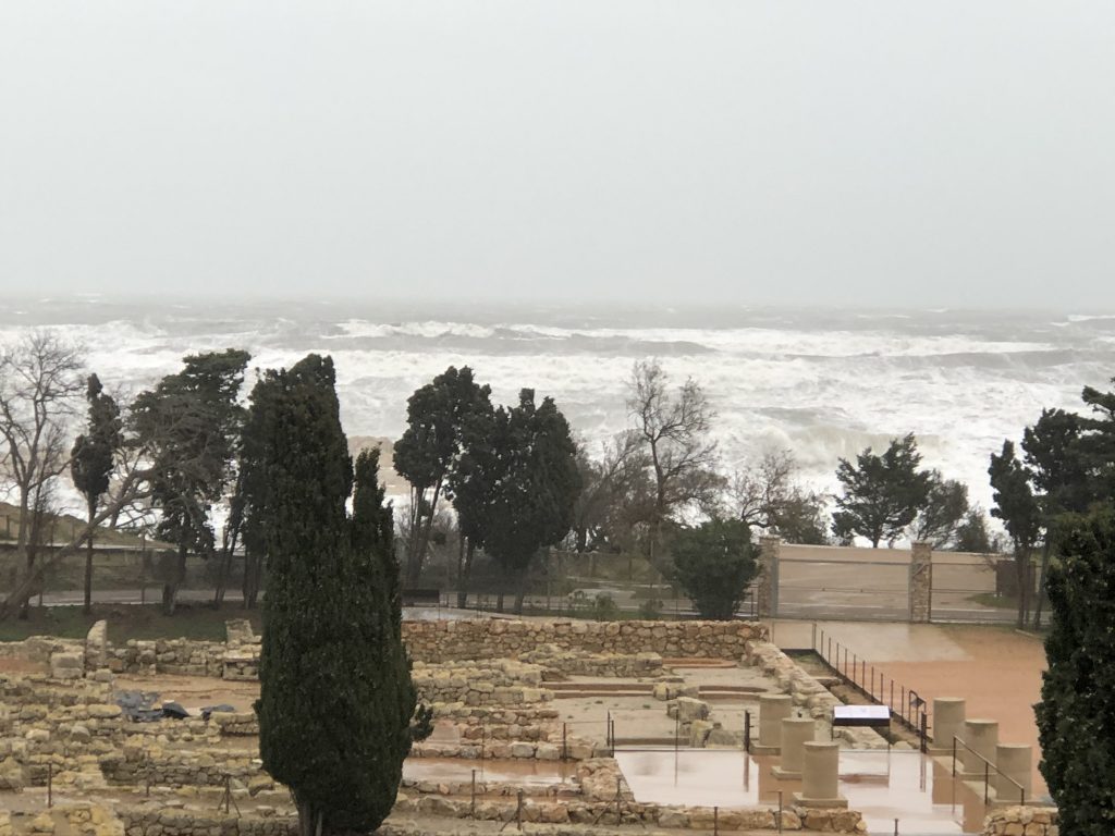
The rising sea level and increased frequency of severe storms are provoking the progressive erosion of Ampurias’ coast. They increasingly threaten the cultural heritage, in particular the eastern sector of the Phocaean Apoikie EMPORION. With special funding from the President’s Office of the DAI, a rescue excavation was carried out here in November 2019. Just in time, it yielded evidence of the remains of houses built around 540/30 BC by the first generation of Greek settlers.
The urgency of the documentation of cultural assets endangered by climate change was dramatically expressed, as was the need to study climatic phenomena and the environment in a diachronic manner, especially also with regard to the future.
For this goal, DAI Groundcheck came at the right moment: in February 2020, the collaboration of archaeologists Pere Castanyer, Marta Santos (both MAC-Empúries), Dirce Marzoli (DAI-Madrid), geographer Helmut Brückner (Univ. Cologne), geologist Ramon Juliá (Barcelona) and computer scientist Daniel Baños, in which Holger Schüttrumpf and Jan Oetjen (RWTH Aachen Univ) have also been participating since 2021.
The starting point is the generation of a 3D GIS model of the real scale, including the sea. Based on the previous interdisciplinary investigations in the vicinity of Empúries and its territory, six scenarios were developed, which offer a diachronic overview of the landscape and settlement development from the middle of the 6th millennium BC to approx. 2100 AD with kaleidoscope-like insights (Fig. 3). The retrospective scenarios are based on archaeological, historical, and geoarchaeological evidence; the prognostic scenarios on IPCC 2019 predictions of future sea-level rise. This impressively visualizes the accelerated sea-level rise and storm waves caused by global climate change. For this purpose and with regard to archaeological underwater investigations, geophysical-bathymetric documentation is being carried out.
Geological boreholes were sunk in the ground to the north and south of the ancient city. Their evaluation is still in progress; including a feasibility study to determine the oxygen (18O/16O) and carbon (13C/12C) isotope ratios of microfossils from the drill cores as proxies for the palaeoclimate.Geological boreholes were sunk in the ground to the north and south of the ancient city. Their evaluation is still in progress; including a feasibility study to determine the oxygen (18O/16O) and carbon (13C/12C) isotope ratios of microfossils from the drill cores as proxies for the palaeoclimate.