Documentation of Monuments in Palau Threatened by Climate Change
This project aims to conduct a survey of monuments in Palau that are under acute threat by climate change. The Republic of Palau consists of a large number of islands with a total landmass of 459km². The largest island, Babeldaob (376km²), is of volcanic origin and was intensively shaped by anthropogenic activity from about 500 BC onwards. Countless monumental structures dominate the landscape and attest to a formerly high population density with a hierarchical social structure. The rest of the island nation consists of hundreds of so-called Rock Islands, small karst islands of often only a few square kilometers, which today are covered with tropical vegetation. In 2012, the Rock Islands have been declared a UNESCO World Heritage Site. In a period of strong climatic changes between the so-called Medieval Warm Period (MWP, 800 – 1300 AD) and the Little Ice Age (LIA, 1400 – 1800 AD), a dramatic change can be detected in the archaeological record of Palau. During the MWP, the large island of Babeldaob is almost completely abandoned, and settlement on some of the Rock Islands increases instead. This caused profound changes in almost all aspects of life, such as social organization, settlement structure, subsistence, and certainly religious aspects. For the Little Ice Age, however, the opposite can be traced: Settlements on the Rock Islands are abandoned and people settle again on the large volcanic islands. Both phenomena are interpreted as consequences of climatic changes, specifically the shift of the intra-tropical convergence zone, which had a strong impact on rainfall and droughts.
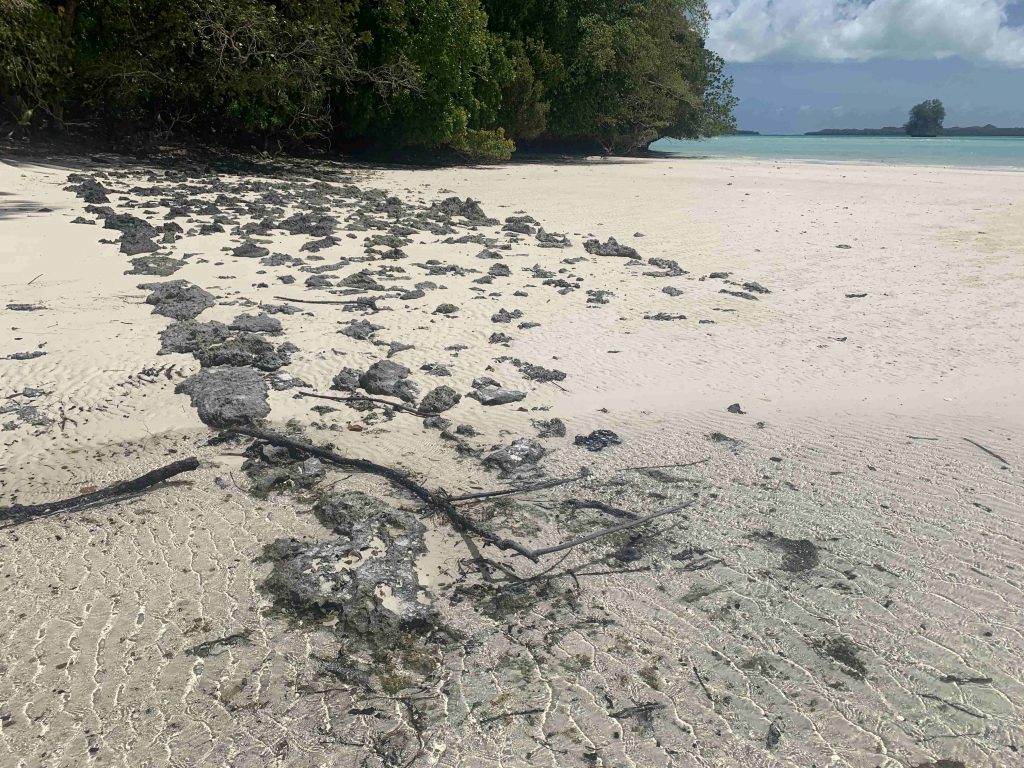
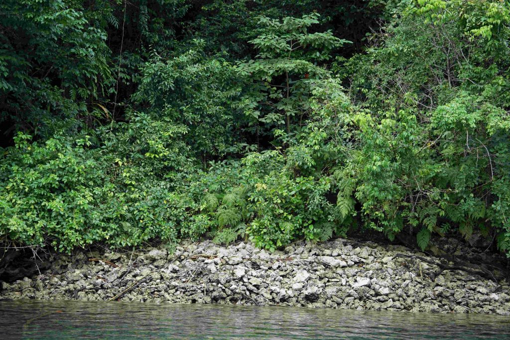
Hazards from changing climate conditions once led to settlement and then abandonment of the Rock Islands; today, archaeological legacies of these interactions are threatened by climate change. Many coastal structures, such as house platforms, wells, weir walls, boat ramps, piers, and paved walkways are acutely threatened by increasing extreme weather events such as typhoons and, in the mid-term, by rising sea levels. To date, there has been no systematic documentation of these structures. In consultation with local authorities and the local population, particularly endangered sites are to be identified and recorded using state-of-the-art documentation methods. For this purpose, we have both a drone for georeferenced SfM images and a LiDAR drone for the creation of digital terrain models (after extracting the vegetation). This technique is best suited for detailed imaging on the forested and difficult-to-access islands. Besides the documentation of the endangered structures, their spatial arrangement in the terrain, and their functional assignment, one goal is to get clues about the intensity of occupation on the Rock Islands based on the density of the various structures. Here it is of interest to relate these to projections for Babeldaob’s population numbers prior to climate-induced migrations.