New lecture programme of the Istanbul department is online!
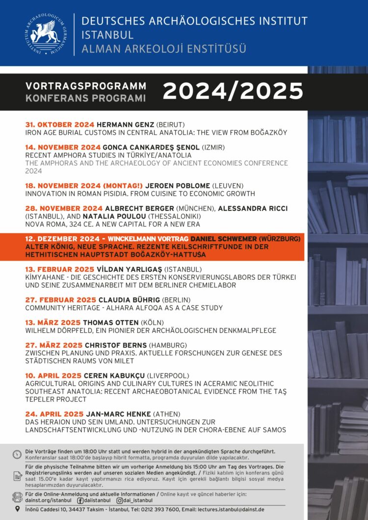
The new lecture programme 2024/ 2025 is online! The lectures will take place on Thursdays at 18:00 (Istanbul time) in the announced language. The events will be hybrid, both physical […]

The new lecture programme 2024/ 2025 is online! The lectures will take place on Thursdays at 18:00 (Istanbul time) in the announced language. The events will be hybrid, both physical […]
In September 2024, the Museum of West African Art (MOWAA) and the German Archaeological Institute (DAI) came together to deliver a four-part webinar series, focusing on Heritage Digitization and Archaeo-Informatics. […]
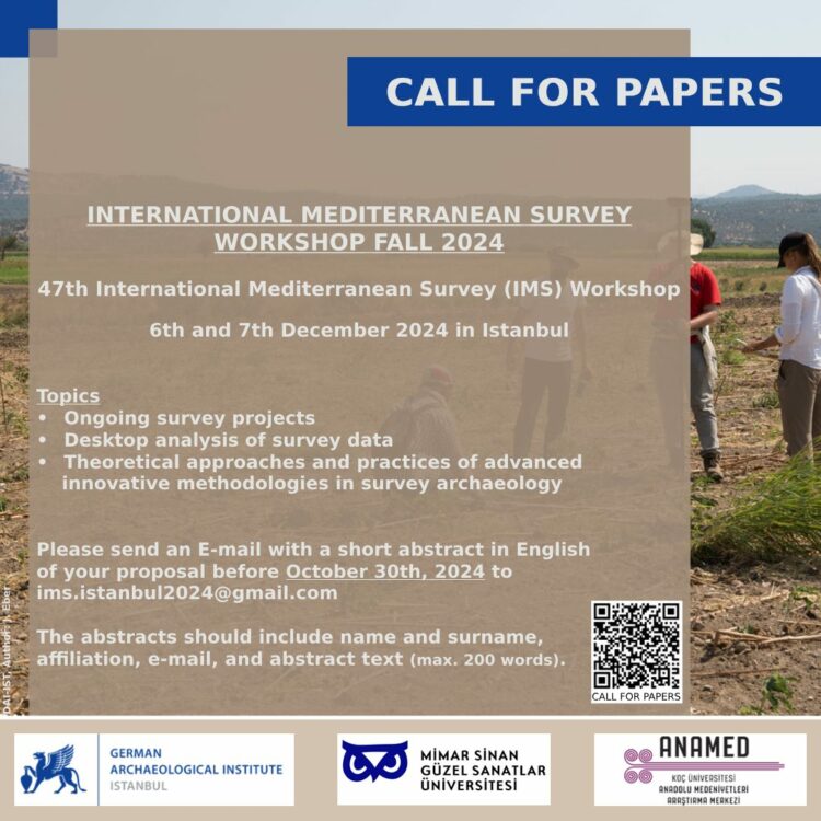
The German Archaeological Institute, Istanbul Department and the Mimar Sinan Fine Arts University invite you to the 47th International Mediterranean Survey (IMS) workshop, which will be held on the 6th and […]
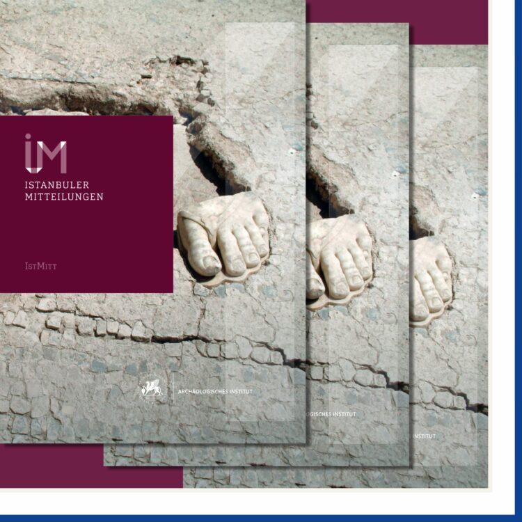
The 73rd volume of the Istanbuler Mitteilungen has been published! From the Neolithic architecture of eastern Anatolia to the Roman imperial period on the west coast of Anatolia and the […]
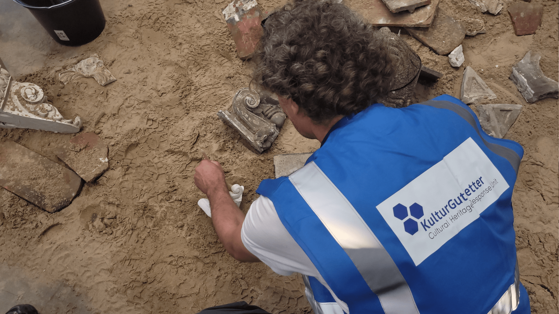
The aim of the Cultural Heritage Response Unit (CHRU) of the KulturGutRetter project is to secure monuments and other cultural assets quickly and professionally in the event of a disaster. […]
At the end of June, 80 volunteers from the KulturGutRetter project and the Federal Agency for Technical Relief (THW) started their training in Hilden. In a two-day practical course, the […]
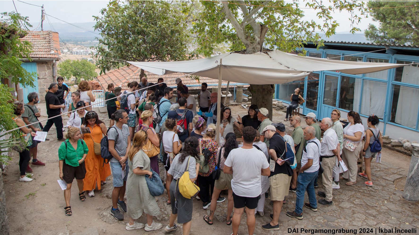
Pergamon Excavation House, the heart and center of the Pergamon Excavation, opened its doors to visitors from Bergama on Saturday, September 7, 2024. This special event, organized for the first time within the scope of ‘Pergamon Meetings’ with the contributions of the Ministry of Culture and Tourism of the Republic of Türkiye and Bergama District Municipality, aimed to offer participants a day full of history and archaeology.
Pergamon Kazısının kalbi ve ana merkezi olan Pergamon Kazı Evi, 7 Eylül 2024 Cumartesi günü kapılarını Bergamalı ziyaretçilerine açtı. Türkiye Cumhuriyeti Kültür ve Turizm Bakanlığı ile Bergama İlçe Belediyesinin katkılarıyla düzenlenen ‘Pergamon Buluşmaları’ kapsamında ilk defa gerçekleştirilen bu özel etkinlik, katılımcılara tarih ve arkeoloji dolu bir gün sunmayı amaçladı.
Blogbeitrag über Schwierigkeiten der Shea Baum Landwirtschaft und archäologisch inspirierte Lösungsansätze
Blog discussing problems Shea agriculture is facing and possible solutions inspired by archaeological results
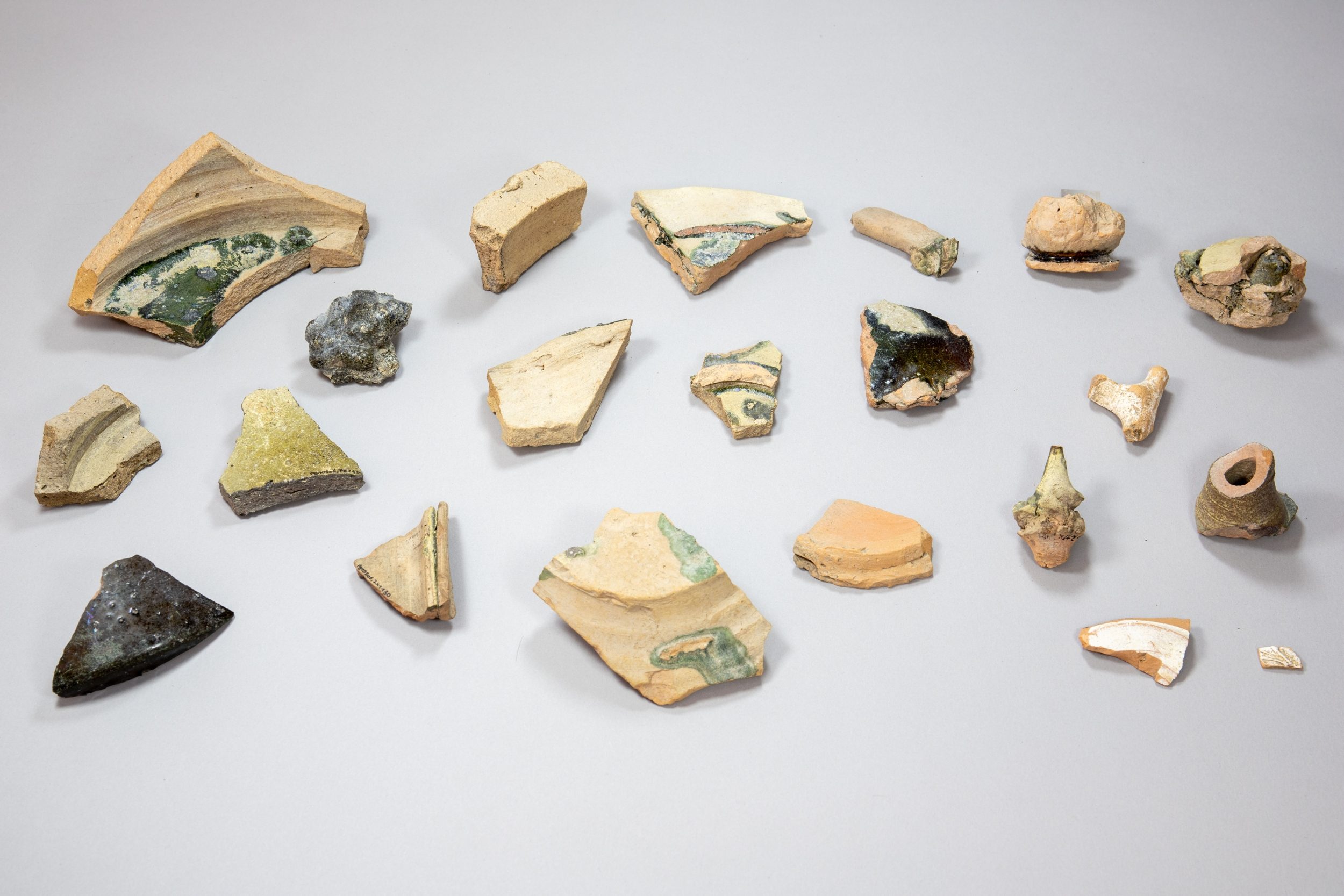
New findings from Pergamon reveal evidence of local lead-glazed pottery production, dating to the late Hellenistic and early Imperial periods. Production waste, including misfired vessels and stacking devices, was found in rubbish layers on the city’s northern East Slope. These discoveries highlight Pergamon’s urban production infrastructure and raise questions about the region’s specialized, resource-intensive ceramic craftsmanship and its eventual decline.
by David Wigg-Wolf – english/german On August 21st/22nd 2024, 25 members of the Nomisma.org consortium and the DARIAH-EU Digital Numismatics Working Group from nine countries met at the Römisch-Germanische Kommission […]
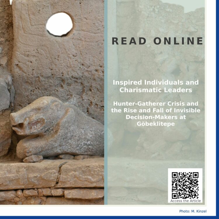
Don’t miss the newest open sources paper on “Inspired individuals and charismatic leaders.Hunter-gatherer crisis and the rise and fall of invisible decision-makers at Göbeklitepe” looking at the evidence for charasmatic […]
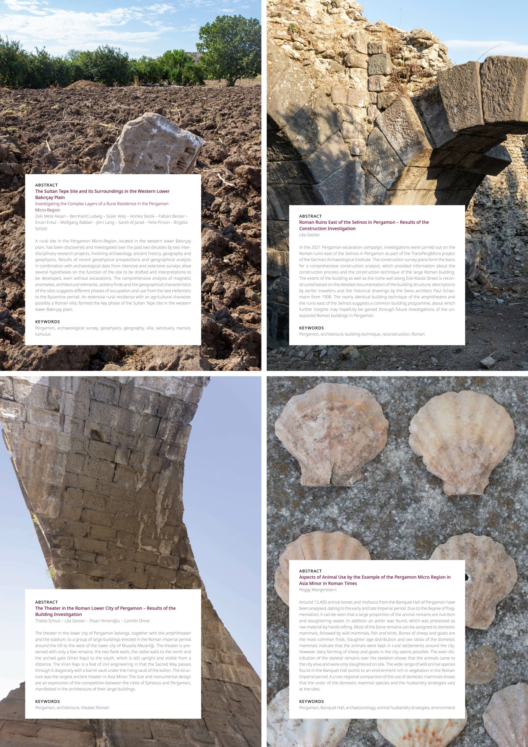
We are excited to announce that four new articles from the TransPergMicro project have been recently published in the latest volume of the Istanbuler Mitteilungen. These articles shed light on various aspects of Pergamon and the micro-region during the Hellenistic and Roman periods.
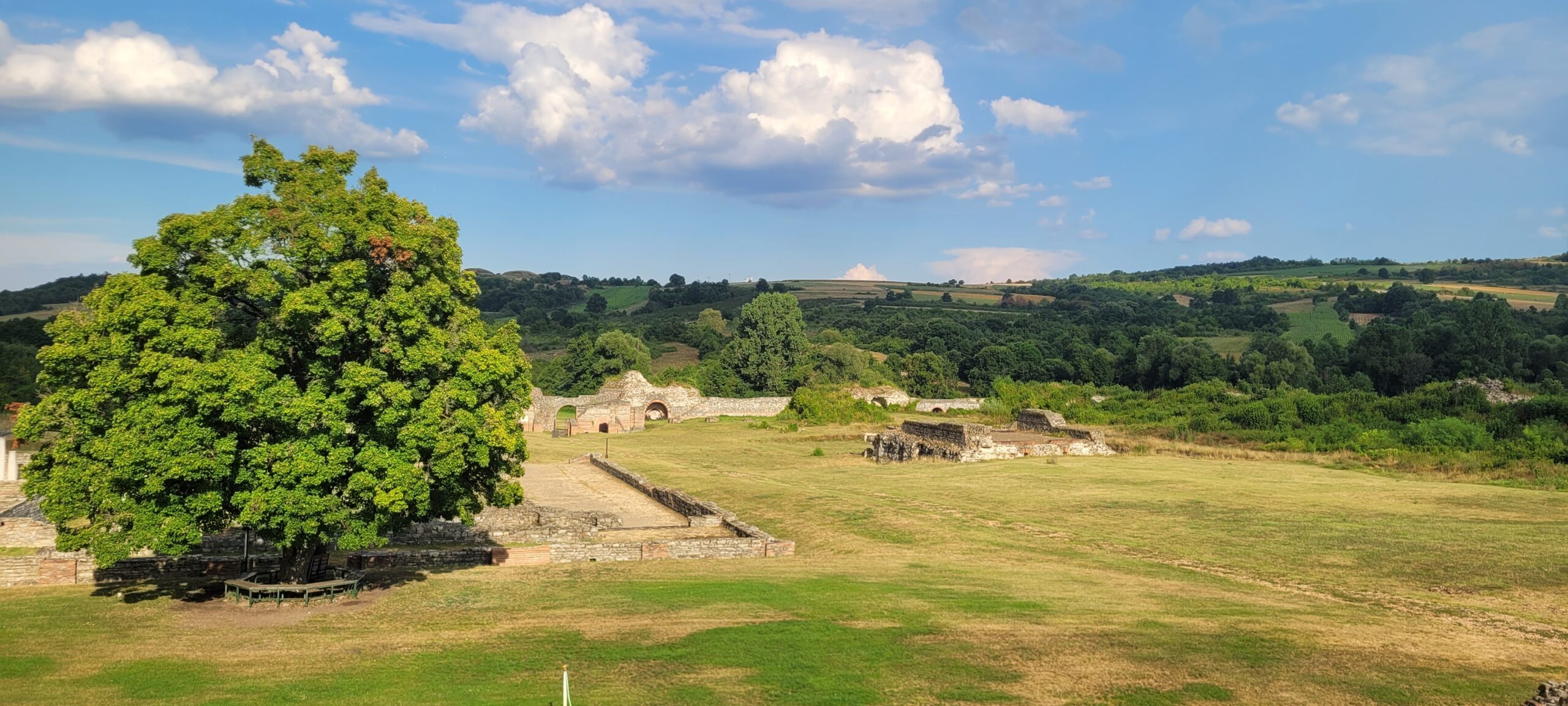
von Christoph Rummel und Max Adam Seit mehr als 20 Jahren erforscht die Römisch-Germanische-Kommission gemeinsam mit serbischen Partnern des Archäologischen Instituts in Belgrad und des Nationalmuseums in Zaječar die spätrömische […]